···
Satellite view of Russia and Central Asia in winter, with partial snow cover and Arctic ice cap. This image was compiled from data acquired by Landsat 7 & 8 satellites. Image details File size:
49.8 MB (2.8 MB Compressed download)
Open your image file to the full size using image processing software.
Dimensions:
4961 x 3507 px | 42 x 29.7 cm | 16.5 x 11.7 inches | 300dpi
More information:
Satellite Image of Russia and Central Asia in Winter
Search stock photos by tags
Similar stock images Color satellite image of Russia and Northern Asia. Stock Photo https://www.alamy.com/licenses-and-pricing/?v=1 https://www.alamy.com/color-satellite-image-of-russia-and-northern-asia-image597466697.html RM 2WM0XT9 – Color satellite image of Russia and Northern Asia. CENTRAL ASIA - 08 August 2019 - A portion of the Volga River is pictured as the International Space Station orbited above Russia near the Caspian Sea Stock Photo https://www.alamy.com/licenses-and-pricing/?v=1 https://www.alamy.com/central-asia-08-august-2019-a-portion-of-the-volga-river-is-pictured-as-the-international-space-station-orbited-above-russia-near-the-caspian-sea-image385151303.html RF 2DAH4BK – CENTRAL ASIA - 08 August 2019 - A portion of the Volga River is pictured as the International Space Station orbited above Russia near the Caspian Sea For decades, Landsat satellites have documented the desiccation of the Aral Sea in Central Asia. Once one of the largest seas in the world, it shrunk to a tenth of its original volume after Russia diverted its feeder rivers in the 1960s. Scientists studyi Stock Photo https://www.alamy.com/licenses-and-pricing/?v=1 https://www.alamy.com/stock-photo-for-decades-landsat-satellites-have-documented-the-desiccation-of-74286546.html RM E8T16X – For decades, Landsat satellites have documented the desiccation of the Aral Sea in Central Asia. Once one of the largest seas in the world, it shrunk to a tenth of its original volume after Russia diverted its feeder rivers in the 1960s. Scientists studyi A lone cloud with well-defined edges hovers over part of the Caspian Sea. Stock Photo https://www.alamy.com/licenses-and-pricing/?v=1 https://www.alamy.com/a-lone-cloud-with-well-defined-edges-hovers-over-part-of-the-caspian-sea-image574923370.html RF 2TBA0HE – A lone cloud with well-defined edges hovers over part of the Caspian Sea. Map of Eurasia. Detailed satellite view of the Earth and its landforms, focused on Europe and Asia. Elements of this image furnished by NASA Stock Photo https://www.alamy.com/licenses-and-pricing/?v=1 https://www.alamy.com/map-of-eurasia-detailed-satellite-view-of-the-earth-and-its-landforms-image150642318.html RF JN29PP – Map of Eurasia. Detailed satellite view of the Earth and its landforms, focused on Europe and Asia. Elements of this image furnished by NASA This remarkably complete view of Earth at night is a composite of cloud-free, nighttime images. Stock Photo https://www.alamy.com/licenses-and-pricing/?v=1 https://www.alamy.com/this-remarkably-complete-view-of-earth-at-night-is-a-composite-of-image62746449.html RM DJ29MH – This remarkably complete view of Earth at night is a composite of cloud-free, nighttime images. Map of Europe and Asia. Detailed flat satellite view of the Earth and its landforms, in summer. 3D illustration. Elements of this image furnished by N Stock Photo https://www.alamy.com/licenses-and-pricing/?v=1 https://www.alamy.com/map-of-europe-and-asia-detailed-flat-satellite-view-of-the-earth-and-its-landforms-in-summer-3d-illustration-elements-of-this-image-furnished-by-n-image379955629.html RF 2D24D7W – Map of Europe and Asia. Detailed flat satellite view of the Earth and its landforms, in summer. 3D illustration. Elements of this image furnished by N Russia at night in the earth planet rotating from space Stock Photo https://www.alamy.com/licenses-and-pricing/?v=1 https://www.alamy.com/russia-at-night-in-the-earth-planet-rotating-from-space-image433401979.html RF 2G534J3 – Russia at night in the earth planet rotating from space Color satellite image of Russia and Northern Asia, with borders. Stock Photo https://www.alamy.com/licenses-and-pricing/?v=1 https://www.alamy.com/color-satellite-image-of-russia-and-northern-asia-with-borders-image597466718.html RM 2WM0XW2 – Color satellite image of Russia and Northern Asia, with borders. Satellite view of Russia and Central Asia in winter, with partial snow cover. This image was compiled from data acquired by Landsat 7 & 8 satellites. Stock Photo https://www.alamy.com/licenses-and-pricing/?v=1 https://www.alamy.com/stock-photo-satellite-view-of-russia-and-central-asia-in-winter-with-partial-snow-112373320.html RM GER18T – Satellite view of Russia and Central Asia in winter, with partial snow cover. This image was compiled from data acquired by Landsat 7 & 8 satellites. Satellite view of Russia and Central Asia in winter, with partial snow cover (with country boundaries). This image was compiled from data acquired by Landsat 7 & 8 satellites. Stock Photo https://www.alamy.com/licenses-and-pricing/?v=1 https://www.alamy.com/stock-photo-satellite-view-of-russia-and-central-asia-in-winter-with-partial-snow-112373325.html RM GER191 – Satellite view of Russia and Central Asia in winter, with partial snow cover (with country boundaries). This image was compiled from data acquired by Landsat 7 & 8 satellites. Satellite view of Russia and Central Asia in winter, with partial snow cover and Arctic ice cap (with country boundaries). This image was compiled from data acquired by Landsat 7 & 8 satellites. Stock Photo https://www.alamy.com/licenses-and-pricing/?v=1 https://www.alamy.com/stock-photo-satellite-view-of-russia-and-central-asia-in-winter-with-partial-snow-112373322.html RM GER18X – Satellite view of Russia and Central Asia in winter, with partial snow cover and Arctic ice cap (with country boundaries). This image was compiled from data acquired by Landsat 7 & 8 satellites. 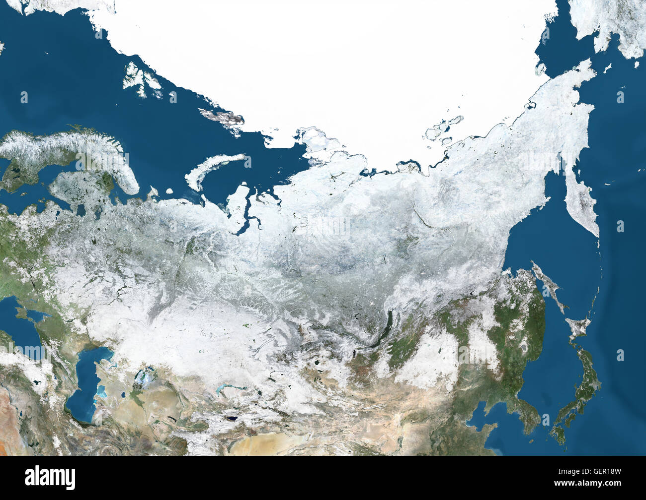