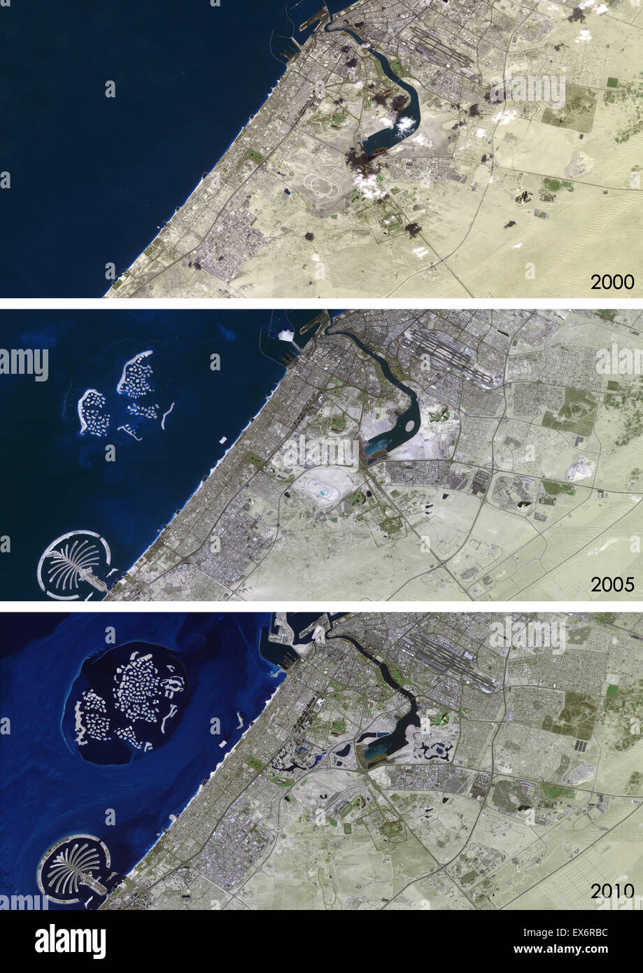
Satellite view of Dubai, United Arab Emirates in 2000, 2005 and 2010. This before and after image shows urban expansion over
RMID:Image ID:EX6RBC
Image details
Contributor:
Universal Images Group North America LLC / Alamy Stock PhotoImage ID:
EX6RBCFile size:
49.8 MB (2.6 MB Compressed download)Releases:
Model - no | Property - noDo I need a release?Dimensions:
3508 x 4961 px | 29.7 x 42 cm | 11.7 x 16.5 inches | 300dpiDate taken:
2000Photographer:
Planet Observer UIGMore information:
This image could have imperfections as it’s either historical or reportage.
Satellite view of Dubai, United Arab Emirates in 2000, 2005 and 2010. This before and after image shows urban expansion over the years and the construction of the World Islands and the Palm island called Palm Jumeirah.