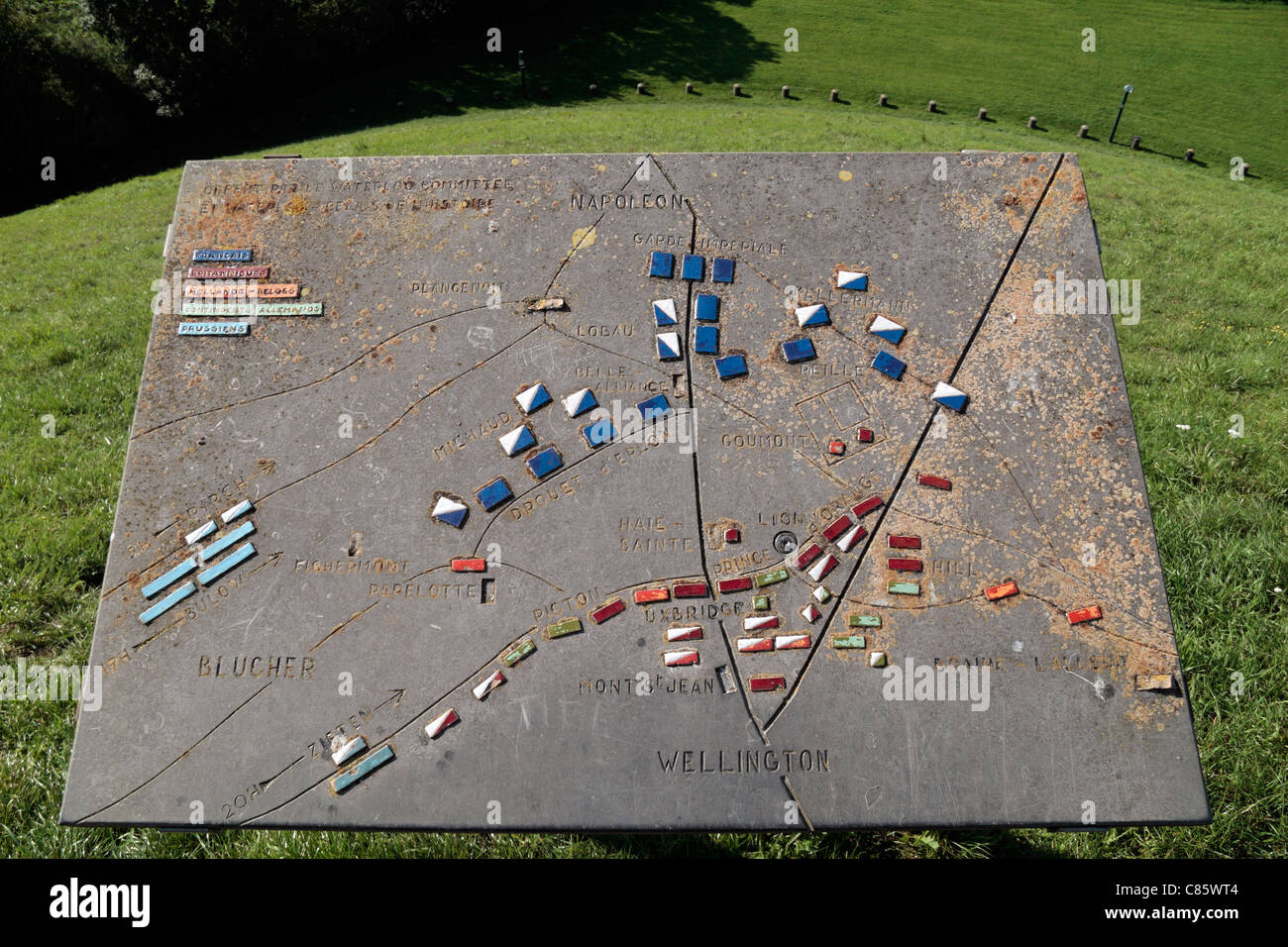
Relief map showing the Battle of Waterloo on top of the Butte du Lion (or 'Lion's mound') on the Waterloo battlefield, Belgium.
RMID:Image ID:C85WT4
Image details
Contributor:
Maurice Savage / Alamy Stock PhotoImage ID:
C85WT4File size:
25 MB (1.8 MB Compressed download)Releases:
Model - no | Property - noDo I need a release?Dimensions:
3624 x 2415 px | 30.7 x 20.4 cm | 12.1 x 8.1 inches | 300dpiDate taken:
25 August 2011Location:
Waterloo Battlefield, Waterloo, Southern BelgiumMore information:
"The Lion's Mound (or "Lion's Hillock", "Butte du Lion" in French, "Leeuw van Waterloo" in Dutch) is a large conical artificial hill raised on the battlefield of Waterloo to commemorate the location where William II of the Netherlands (the Prince of Orange) was knocked from his horse by a musket ball to the shoulder during the battle. It was ordered constructed in 1820 by his father, King William I of The Netherlands, and completed in 1826. The younger William had fought at the Battle of Quatre Bras (June 16) and the Battle of Waterloo (June 18)."