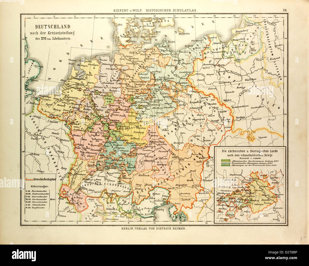
MAP OF GERMANY IN THE 16TH CENTURY
RMID:Image ID:D2T8BP
Image details
Contributor:
Penta Springs Limited / Alamy Stock PhotoImage ID:
D2T8BPFile size:
51.6 MB (4 MB Compressed download)Releases:
Model - no | Property - noDo I need a release?Dimensions:
4777 x 3778 px | 40.4 x 32 cm | 15.9 x 12.6 inches | 300dpiDate taken:
5 October 2012Photographer:
ArtokoloroMore information:
This image could have imperfections as it’s either historical or reportage.
MAP OF GERMANY IN THE 16TH CENTURY