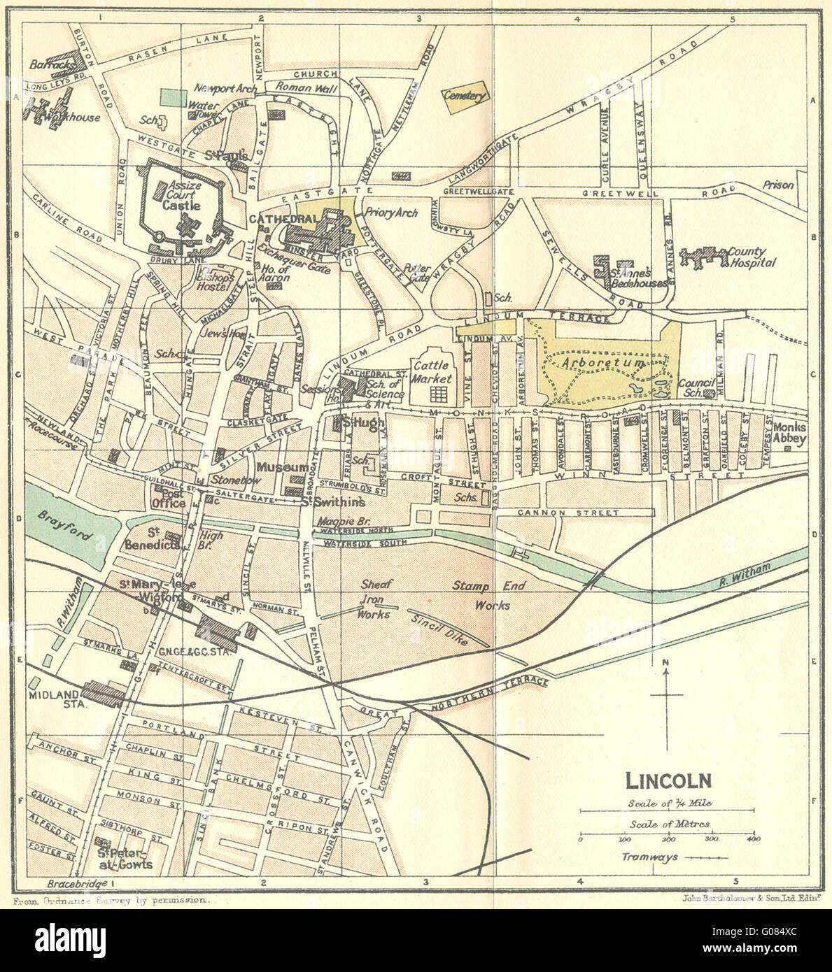
LINCS: Lincoln Town Plan, 1924 vintage map
RFID:Image ID:G084XC
Image details
Contributor:
Antiqua Print Gallery / Alamy Stock PhotoImage ID:
G084XCFile size:
8.2 MB (745.7 KB Compressed download)Releases:
Model - no | Property - noDo I need a release?Dimensions:
1622 x 1772 px | 27.5 x 30 cm | 10.8 x 11.8 inches | 150dpiDate taken:
1924Location:
LincolnshireMore information:
This image could have imperfections as it’s either historical or reportage.
'Lincoln'. Artist/engraver/cartographer: Engraved by John Bartholomew & Son. Provenance: "The blue guides England", edited by Findlay Muirhead; Published by Macmillan and Co., Ltd, London. & Librairie Hachette & Cie, Paris. 2nd Edition. Type: Colour vintage map.