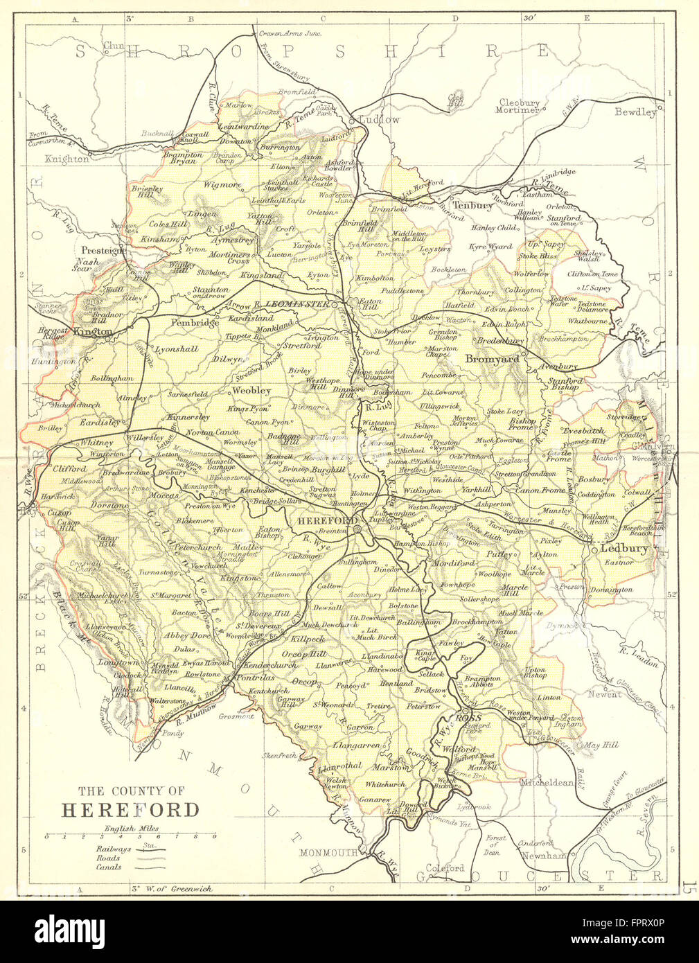
HEREFORD: Philip, 1876 antique map
RFID:Image ID:FPRX0P
Image details
Contributor:
Antiqua Print Gallery / Alamy Stock PhotoImage ID:
FPRX0PFile size:
13.2 MB (1.3 MB Compressed download)Releases:
Model - no | Property - noDo I need a release?Dimensions:
1896 x 2442 px | 32.1 x 41.4 cm | 12.6 x 16.3 inches | 150dpiDate taken:
1876Location:
HerefordshireMore information:
This image could have imperfections as it’s either historical or reportage.
'The County of Hereford'. Artist/engraver/cartographer: Engraved by Philip. Provenance: "Philip's Handy Atlas of the Counties of England"; Published by George Philip & Son, London. Type: Antique engraved map with Colour.