Great Mississippi River Flood, 1927
Image details
Contributor:
Science History Images / Alamy Stock PhotoImage ID:
HRNTR3File size:
47.3 MB (1.3 MB Compressed download)Releases:
Model - no | Property - noDo I need a release?Dimensions:
4800 x 3446 px | 40.6 x 29.2 cm | 16 x 11.5 inches | 300dpiPhotographer:
Photo ResearchersMore information:
This image could have imperfections as it’s either historical or reportage.
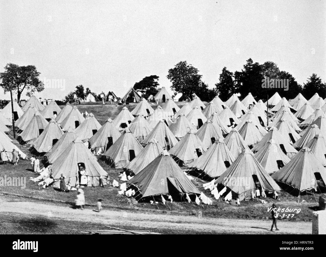
The Great Mississippi Flood of 1927 was the most destructive river flood in the history of the United States. The flood began when heavy rains pounded the central basin of the Mississippi in the summer of 1926. By September, the Mississippi's tributaries in Kansas and Iowa were swollen to capacity. Flooding overtook the levees causing the Mounds Landing to break with more than double the water volume of Niagara Falls. The Mississippi River broke out of its levee system in 145 places and flooded 27, 000 square miles. This water flooded an area 50 miles wide and more than 99 miles long. The flood caused over $400 million in damages and killed 246 people in seven states. The flood affected Arkansas, Illinois, Kentucky, Louisiana, Mississippi, Missouri, Tennessee, Texas, Oklahoma and Kansas. By May 1927, the Mississippi River below Memphis, Tennessee, reached a width of 60 miles. Photo originally captioned: "The Great Mississippi River Flood of 1927. A refugee camp at Vicksburg, Mississippi, on May 3, 1927. This was a nice camp on high ground. Many refugees had to live on the levees for months until the water receded." Monthly Weather Review Supplement No. 29.