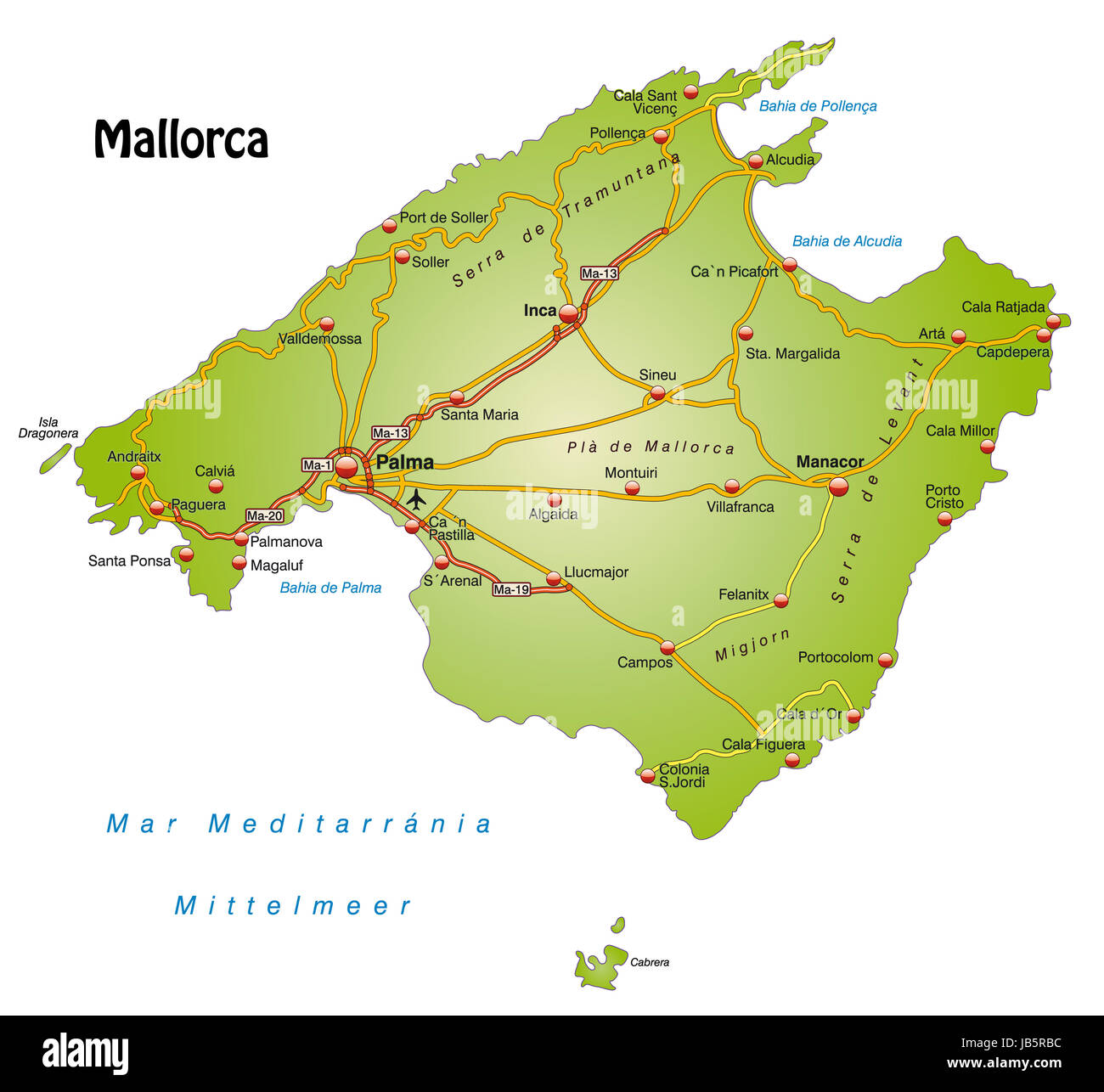
Die Karte ist modern gestaltet und enthält alle wichtigen Topographischen Informationen. Städte, Gewässernetz, Höhenzüge sowie Autobahnen sind enthalten. Die Karte kann sofort eingesetzt werden und ist optimiert für den Druck und den Einsatz in digitalen Medien. Der Farbmodus ist RGB.
RFID:Image ID:JB5RBC
Image details
Contributor:
Panther Media / Alamy Stock PhotoImage ID:
JB5RBCFile size:
50.2 MB (1 MB Compressed download)Releases:
Model - no | Property - noDo I need a release?Dimensions:
4369 x 4020 px | 37 x 34 cm | 14.6 x 13.4 inches | 300dpiDate taken:
25 January 2013More information:
This image could have imperfections as it’s either historical or reportage.