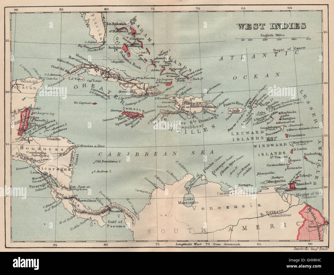
BRITISH WEST INDIES. Showing British Islands/colonies. Caribbean, 1914 old map
RFID:Image ID:GHXRHC
Image details
Contributor:
Antiqua Print Gallery / Alamy Stock PhotoImage ID:
GHXRHCFile size:
9.8 MB (798.3 KB Compressed download)Releases:
Model - no | Property - noDo I need a release?Dimensions:
2133 x 1608 px | 36.1 x 27.2 cm | 14.2 x 10.7 inches | 150dpiDate taken:
1914Location:
West IndiesMore information:
This image could have imperfections as it’s either historical or reportage.
'West Indies '. Artist/engraver/cartographer: Stanford's Geographical Establishment. Provenance: "The Pocket Guide to The West Indies"; Edited by Algeron E. Aspinall; Published by Duckworth & Co., London: 3rd Edition. Type: Vintage colour map.