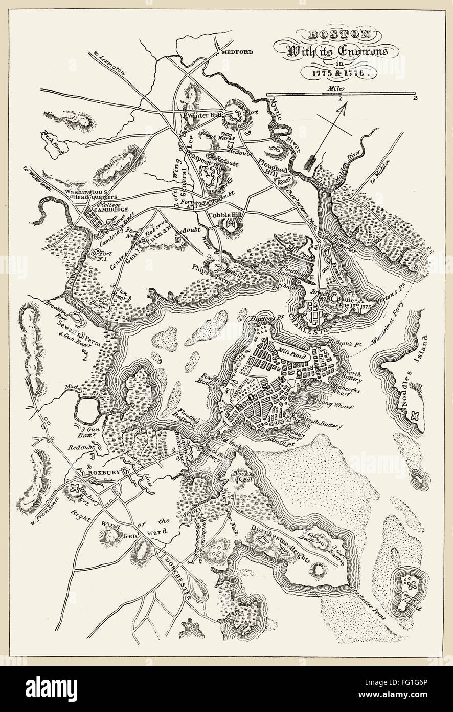
BOSTON: MAP, 1775-1776. /nMap of Boston, Massachusetts, and the surrounding area, 1775-1776. Line engraving, 19th century.
RMID:Image ID:FG1G6P
Image details
Contributor:
GRANGER - Historical Picture Archive / Alamy Stock PhotoImage ID:
FG1G6PFile size:
20.5 MB (1.5 MB Compressed download)Releases:
Model - no | Property - noDo I need a release?Dimensions:
2210 x 3240 px | 18.7 x 27.4 cm | 7.4 x 10.8 inches | 300dpiPhotographer:
Granger, NYC.More information:
This image could have imperfections as it’s either historical or reportage.