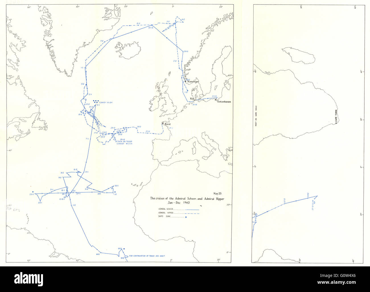
ATLANTIC: Ocean Warfare: Cruises of Admiral Scheer & Hipper, 1940, 1954 map
RFID:Image ID:G0W4X6
Image details
Contributor:
Antiqua Print Gallery / Alamy Stock PhotoImage ID:
G0W4X6File size:
30.8 MB (670.6 KB Compressed download)Releases:
Model - no | Property - noDo I need a release?Dimensions:
3864 x 2783 px | 32.7 x 23.6 cm | 12.9 x 9.3 inches | 300dpiDate taken:
1954Location:
AtlanticMore information:
This image could have imperfections as it’s either historical or reportage.
'Map 25. The Cruises of the Admiral Scheer and Admiral Hipper, January-December 1940'. Artist/engraver/cartographer: Unsigned. Provenance: “The War at Sea 1939-1945”, by Captain S.W. Roskill, D.S.C., R.N.; Published by Her Majesty's Stationery Office, London. Contains public sector information licensed under the Open Government Licence v3.0. Type: Colour vintage map.