Ancash Earthquake, Peru, 1970
Image details
Contributor:
Science History Images / Alamy Stock PhotoImage ID:
HRNTX3File size:
42.9 MB (1.9 MB Compressed download)Releases:
Model - no | Property - noDo I need a release?Dimensions:
4800 x 3124 px | 40.6 x 26.4 cm | 16 x 10.4 inches | 300dpiPhotographer:
Photo ResearchersMore information:
This image could have imperfections as it’s either historical or reportage.
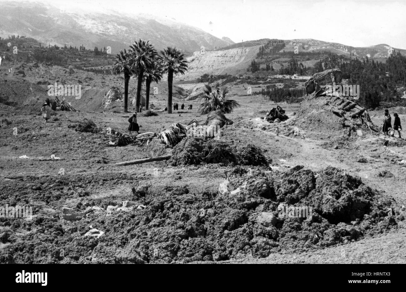
Peru Earthquake May 31, 1970. Site of the Yungay plaza showing the remains of the cathedral walls and four palm trees buried to a depth of 5 meters. The ridge that was overtopped by the Yungay debris lobe is visible in the distance. The wreckage in the right middle ground consists of a smashed bus and truck. The 1970 Ancash earthquake or Great Peruvian Earthquake was an undersea earthquake. Combined with a resultant landslide, it was the worst catastrophic natural disaster ever recorded in the history of Peru. The earthquake affected the Peruvian regions of Ancash and La Libertad. The epicenter of the earthquake was located 35 km off the coast of Casma and Chimbote on the Pacific Ocean, where the Nazca Plate is being subducted by the South American Plate. It had a magnitude of 7.9 to 8.0 on the Richter scale and an intensity of up to VIII on the Mercalli scale. No significant tsunami was reported. The earthquake struck on a Sunday afternoon at 15:23:31 local time (20:23:31 UTC) and lasted 45 seconds. The quake destabilized the northern wall of Mount HuascarÌÁn, causing a rock, ice and snow avalanche and burying the towns of Yungay and Ranrahirca. Five days after the earthquake, Peruvian officials feared a death toll as high as 30, 000. Several days later that figure was tentatively raised to 50, 000. An Associated Press dispatch on July 14 said Peru's Minister of Health now estimated the number of dead and missing persons to be 70, 000. It may be impossible ever to assess fully the toll of this seismic disaster.