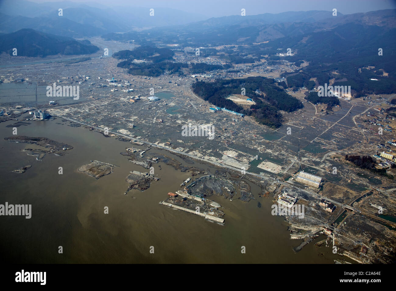
Aerial view of damage to Rikuzentakata, Iwate Prefecture after a 9. 0 magnitude earthquake and subsequent tsunami devastated
RMID:Image ID:C2A64E
Image details
Contributor:
Pacific Press Service / Alamy Stock PhotoImage ID:
C2A64EFile size:
60.2 MB (3 MB Compressed download)Releases:
Model - no | Property - noDo I need a release?Dimensions:
5616 x 3744 px | 47.5 x 31.7 cm | 18.7 x 12.5 inches | 300dpiDate taken:
13 March 2011Location:
Rikuzentakata, Iwate Prefecture, JapanPhotographer:
Fusao Ono / Tohan KokuMore information:
This image could have imperfections as it’s either historical or reportage.
Aerial view of damage to Rikuzentakata, Iwate Prefecture after a 9. 0 magnitude earthquake and subsequent tsunami devastated the area in northern Japan. The 9. 0 magnitude offshore quake which occurred on March 11 triggered tsunami waves up to over 10m high which destroyed large areas and killed thousands of people. This photo was taken on March 13, 2011.