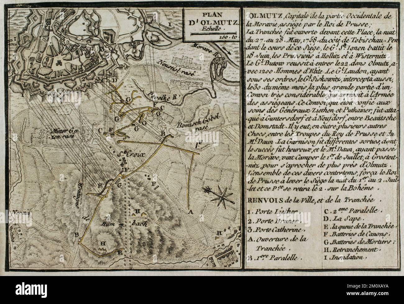
Seven Years War (1756-1763). Map of the Siege of Olmutz (27th May-1st July 1758). The Prussian army, commanded by Frederick the Great, besieged the city of Olmutz in Moravia, which was under Austrian Habsburg control. The resistance of the Austrian army, led by Ernst Dietrich Marschall, forced the Prussians to abandon the siege and retreat from Moravia. Published in 1765 by the cartographer Jean de Beaurain (1696-1771) as an illustration of his Great Map of Germany, with the events that took place during the Seven Years War. Engraving. French edition, 1765. Military Historical Library of Barc
Image details
Contributor:
PRISMA ARCHIVO / Alamy Stock PhotoImage ID:
2M0XAYAFile size:
48.1 MB (2.8 MB Compressed download)Releases:
Model - no | Property - noDo I need a release?Dimensions:
4961 x 3389 px | 42 x 28.7 cm | 16.5 x 11.3 inches | 300dpiDate taken:
5 July 2018Photographer:
Prisma ArchivoMore information:
This image could have imperfections as it’s either historical or reportage.
Seven Years War (1756-1763). Map of the Siege of Olmutz (27th May-1st July 1758). The Prussian army, commanded by Frederick the Great, besieged the city of Olmutz in Moravia, which was under Austrian Habsburg control. The resistance of the Austrian army, led by Ernst Dietrich Marschall, forced the Prussians to abandon the siege and retreat from Moravia. Ppublished in 1765 by the cartographer Jean de Beaurain (1696-1771) as an illustration of his Great Map of Germany, with the events that took place during the Seven Years War. Engraving. French edition, 1765. Military Historical Library of Barcelona (Biblioteca Histórico Militar de Barcelona). Catalonia. Spain.