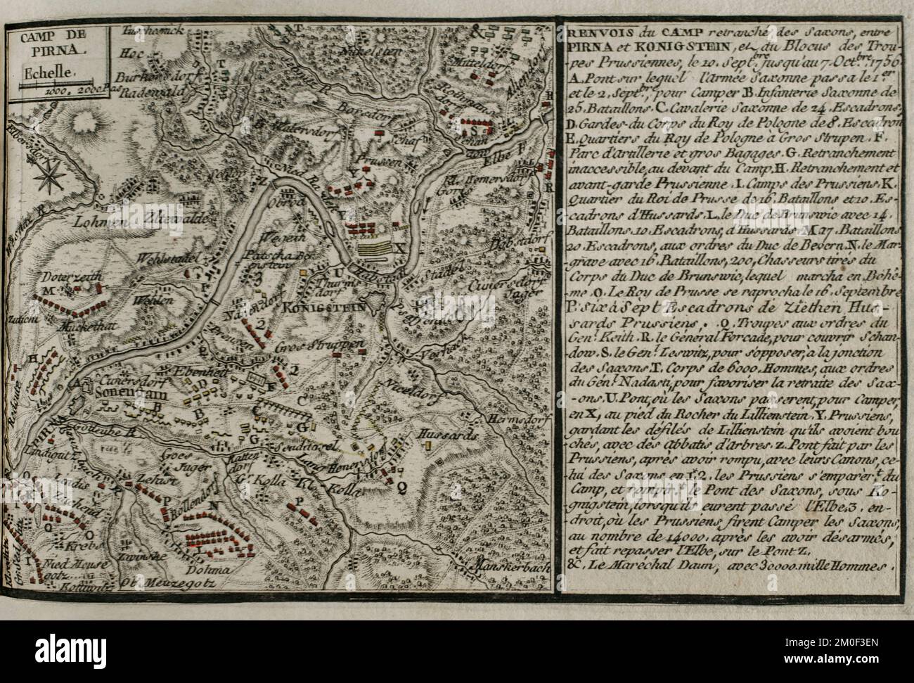
Seven Years War (1756-1763). Map of the encampment at Pirna, 1756. It depicts the bridge which the Saxon army used to cross the Elbe River at Pirna on 1st and 2nd September, and shows the positions of the forces, led by Frederick the Great (King of Prussia), the King of Poland, the Duke of Brunswick, Duke of Bevern, General Forcade, Marshal Keith, Marshal Browne and Prince Maurice, throughout the five weeks on each side of the Elbe. Published in 1765 by the cartographer Jean de Beaurain (1696-1771) as an illustration of his Great Map of Germany, with the events that took place during the Seven
Image details
Contributor:
PRISMA ARCHIVO / Alamy Stock PhotoImage ID:
2M0F3ENFile size:
45.5 MB (2.4 MB Compressed download)Releases:
Model - no | Property - noDo I need a release?Dimensions:
4843 x 3285 px | 41 x 27.8 cm | 16.1 x 11 inches | 300dpiDate taken:
5 July 2018Photographer:
Prisma ArchivoMore information:
This image could have imperfections as it’s either historical or reportage.
Seven Years War (1756-1763). Map of the encampment at Pirna, 1756. It depicts the bridge which the Saxon army used to cross the Elbe River at Pirna on 1st and 2nd September, and shows the positions of the forces, led by Frederick the Great (King of Prussia), the King of Poland, the Duke of Brunswick, Duke of Bevern, General Forcade, Marshal Keith, Marshal Browne and Prince Maurice, throughout the five weeks on each side of the Elbe. Published in 1765 by the cartographer Jean de Beaurain (1696-1771) as an illustration of his Great Map of Germany, with the events that took place during the Seven Years War. Etching and engraving. French edition, 1765. Military Historical Library of Barcelona (Biblioteca Histórico Militar de Barcelona). Catalonia. Spain.