RUSSIA IN EUROPE. Oblasts.Ukraine Baltics Finland Poland. RAPKIN/TALLIS 1851 map
Image details
Contributor:
Antiqua Print Gallery / Alamy Stock PhotoImage ID:
T2J3D6File size:
36.9 MB (2.2 MB Compressed download)Releases:
Model - no | Property - noDo I need a release?Dimensions:
3029 x 4258 px | 25.6 x 36.1 cm | 10.1 x 14.2 inches | 300dpiDate taken:
1851Location:
Russia in EuropeMore information:
This image could have imperfections as it’s either historical or reportage.
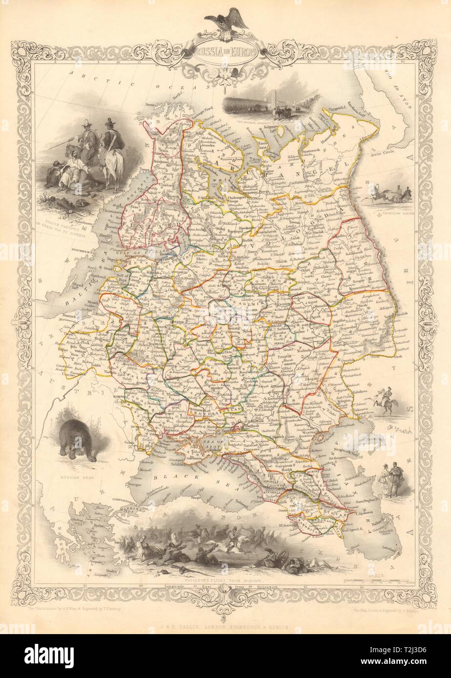
Russia in Europe. Artist/engraver/cartographer: Map drawn and engraved by J. Rapkin; vignette illustrations drawn by AH Wray & engraved by T Fleming. Published by John Tallis & Co. Provenance: "Tallis's Illustrated Atlas and Modern History of the World, Geographical, Political, Commercial and Statistical", edited by R Montgomery Martin Esq., published by John Tallis and Company, London & New York. Type: Antique engraved map by J Rapkin, published by John Tallis. Original outline hand colour, decorative border, and attractive inset vignette views. The map shows European Russia west of the "Ouralian" (Ural) mountains, including Finland and Transcaucasia. Vignettes: Polish Captives on their way to Siberia; The Neoskoi [Nevski] Prospect in St. Petersburg; Travelling Sledge; Russian bear; Napoleon's Flight from Moscow; People in Traditional Dress