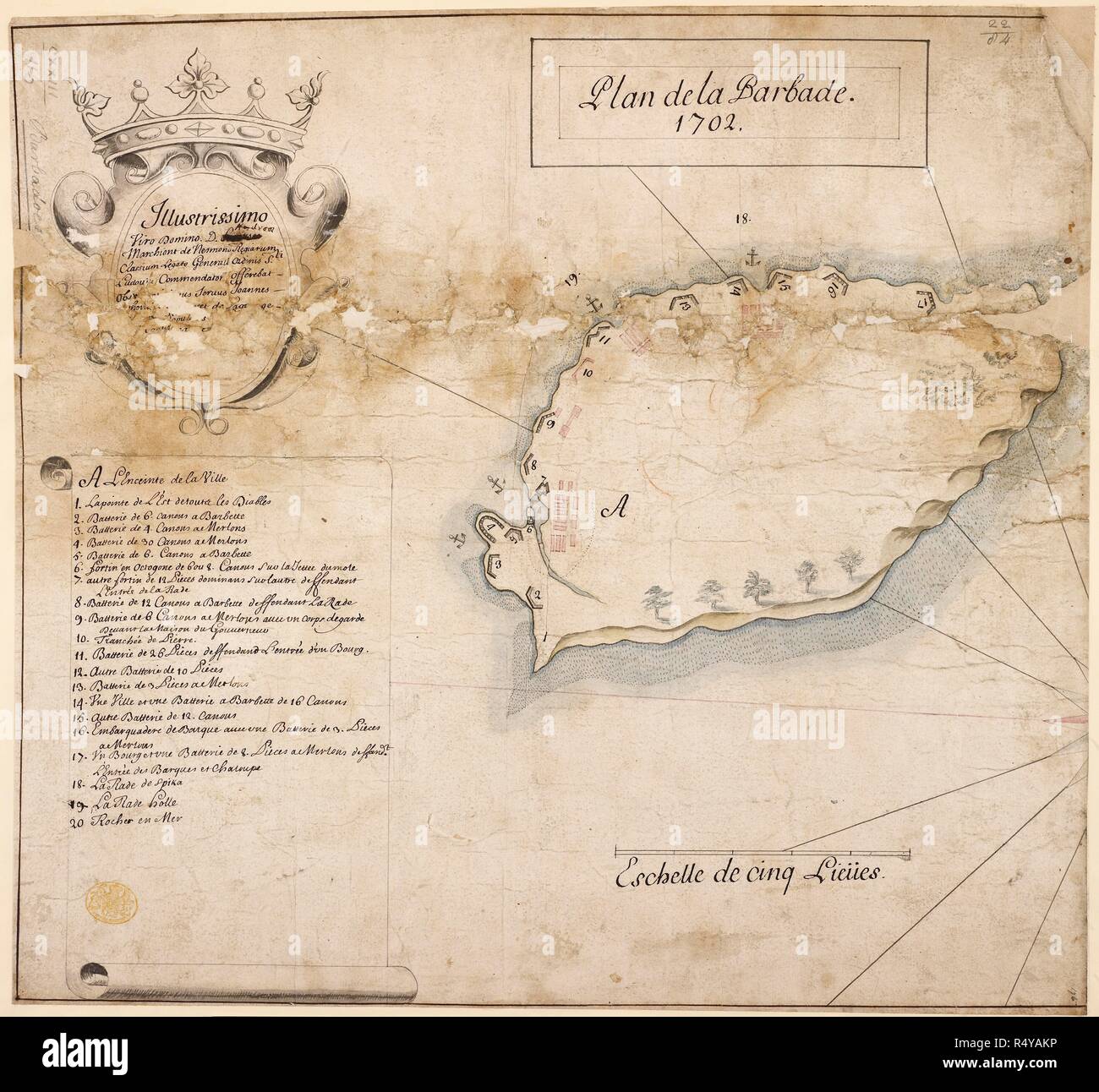
Plan de la Barbade. A simple map of the island of Barbados in 1702. . Plan de la Barbade, 1702. France. published in 1702 "Plan de la Barbade, 1702;" dedicated to AndreÌ, Marquis de Nesmond, Admiral, by Jean .. thov . . . Platevet de Paor; drawn on a scale of one inch to a league. Source: Maps K.Top.123.116. Language: French.
RMID:Image ID:R4YAKP
Image details
Contributor:
Album / British Library / Alamy Stock PhotoImage ID:
R4YAKPFile size:
78 MB (3.6 MB Compressed download)Releases:
Model - no | Property - noDo I need a release?Dimensions:
5428 x 5022 px | 46 x 42.5 cm | 18.1 x 16.7 inches | 300dpiMore information:
This image could have imperfections as it’s either historical or reportage.