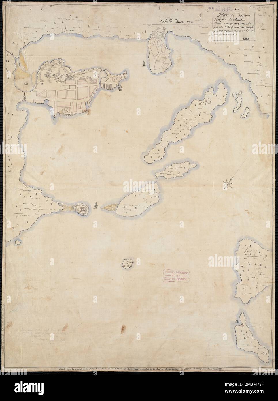
Plan de Boston , Fortification, Massachusetts, Boston, Maps, Manuscript, Early works to 1800, Fortification, Massachusetts, Boston Harbor Islands, Maps, Manuscript, Early works to 1800, Boston Mass., Maps, Manuscript, Early works to 1800, Boston Harbor Islands Mass., Maps, Manuscript, Early works to 1800, Frontenac, Louis de Buade, comte de, 1620-1698 Norman B. Leventhal Map Center Collection
RMID:Image ID:2M3M78F
Image details
Contributor:
piemags/DCM / Alamy Stock PhotoImage ID:
2M3M78FFile size:
215.9 MB (8.9 MB Compressed download)Releases:
Model - no | Property - noDo I need a release?Dimensions:
7485 x 10083 px | 63.4 x 85.4 cm | 25 x 33.6 inches | 300dpiMore information:
This image is a public domain image, which means either that copyright has expired in the image or the copyright holder has waived their copyright. Alamy charges you a fee for access to the high resolution copy of the image.
This image could have imperfections as it’s either historical or reportage.