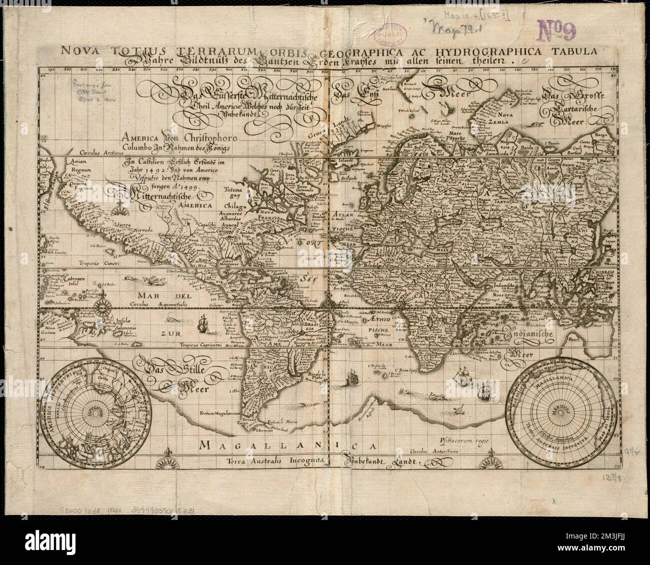
Nova totius terrarum orbis geographica ac hydrographica tabula - Wahre Biltnüss des Gantzen Erden Kraÿses mit allen seinen theilen , World maps, Early works to 1800 Norman B. Leventhal Map Center Collection
RMID:Image ID:2M3JFJJ
Image details
Contributor:
piemags/DCM / Alamy Stock PhotoImage ID:
2M3JFJJFile size:
50.5 MB (3.7 MB Compressed download)Releases:
Model - no | Property - noDo I need a release?Dimensions:
4699 x 3760 px | 39.8 x 31.8 cm | 15.7 x 12.5 inches | 300dpiMore information:
This image is a public domain image, which means either that copyright has expired in the image or the copyright holder has waived their copyright. Alamy charges you a fee for access to the high resolution copy of the image.
This image could have imperfections as it’s either historical or reportage.