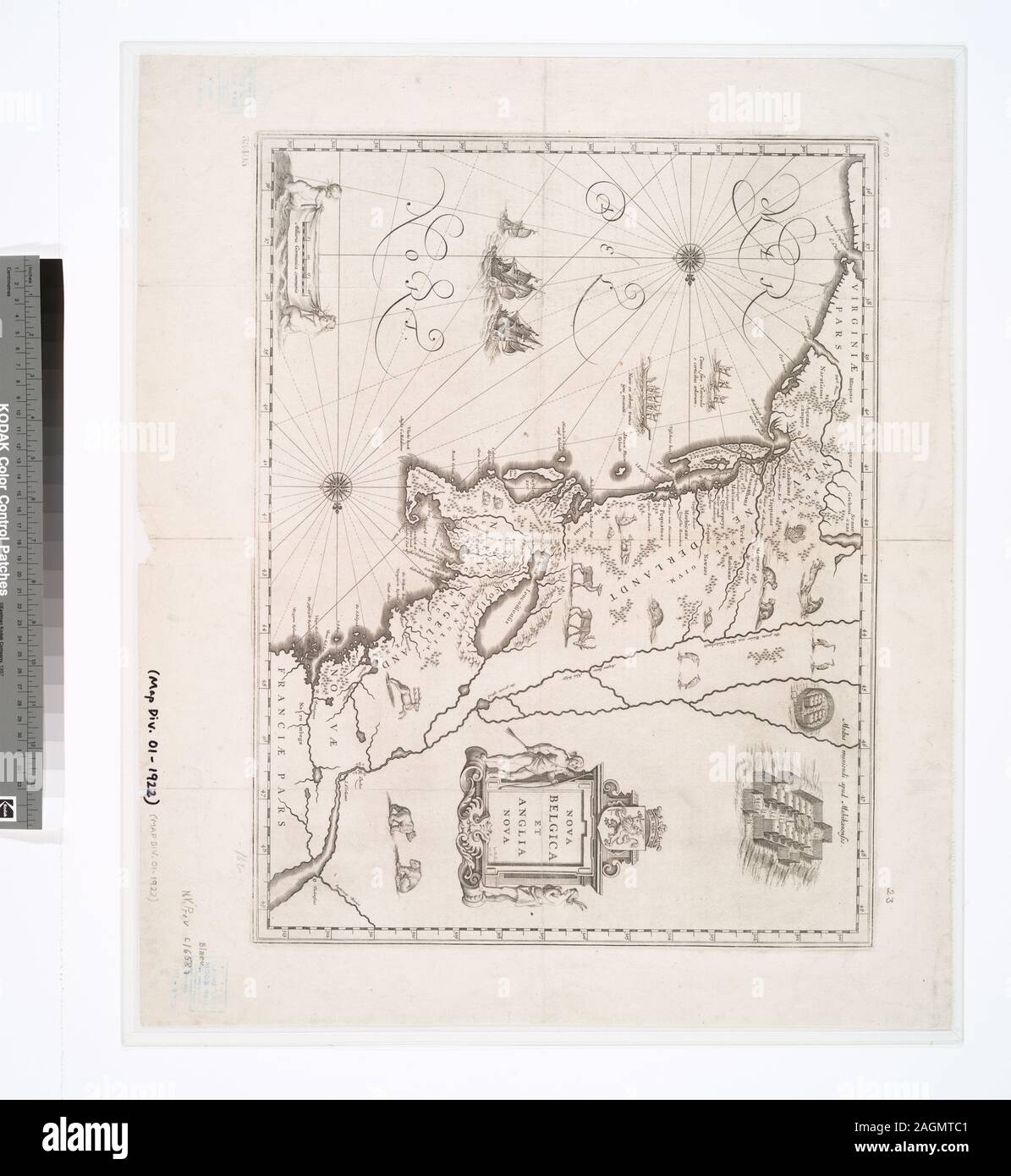
National Endowment for the Humanities Grant for Access to Early Maps of the Middle Atlantic Seaboard. Oriented with north to the right. Relief shown pictorially. Text on verso: Nieuw-Nederlandt, en Nieuw-Engelandt. Citation/Reference: Burden, P.D. Mapping of North America, 241 Citation/Reference: Koeman, C. Atlantes Neerlandici, I, p. 141 Citation/Reference: Stokes, I.N.P. Iconography of Manhattan Island, II, p. 143-144 Appears in Willem and Joan Blaeu's Toonneel des Aerdrycx, oft Nieuwe atlas, 1642 and other eds. Covers New England and the Middle Atlantic states from Penobscot Bay south to th
Image details
Contributor:
Bravo Images / Alamy Stock PhotoImage ID:
2AGMTC1File size:
57.2 MB (2 MB Compressed download)Releases:
Model - no | Property - noDo I need a release?Dimensions:
4288 x 4663 px | 36.3 x 39.5 cm | 14.3 x 15.5 inches | 300dpiMore information:
This image is a public domain image, which means either that copyright has expired in the image or the copyright holder has waived their copyright. Alamy charges you a fee for access to the high resolution copy of the image.
This image could have imperfections as it’s either historical or reportage.
National Endowment for the Humanities Grant for Access to Early Maps of the Middle Atlantic Seaboard. Oriented with north to the right. Relief shown pictorially. Text on verso: Nieuw-Nederlandt, en Nieuw-Engelandt. Citation/Reference: Burden, P.D. Mapping of North America, 241 Citation/Reference: Koeman, C. Atlantes Neerlandici, I, p. 141 Citation/Reference: Stokes, I.N.P. Iconography of Manhattan Island, II, p. 143-144 Appears in Willem and Joan Blaeu's Toonneel des Aerdrycx, oft Nieuwe atlas, 1642 and other eds. Covers New England and the Middle Atlantic states from Penobscot Bay south to the mouth of Chesapeake Bay. Includes decorative cartouche and ill.; Nova Belgica et Anglia Nova.