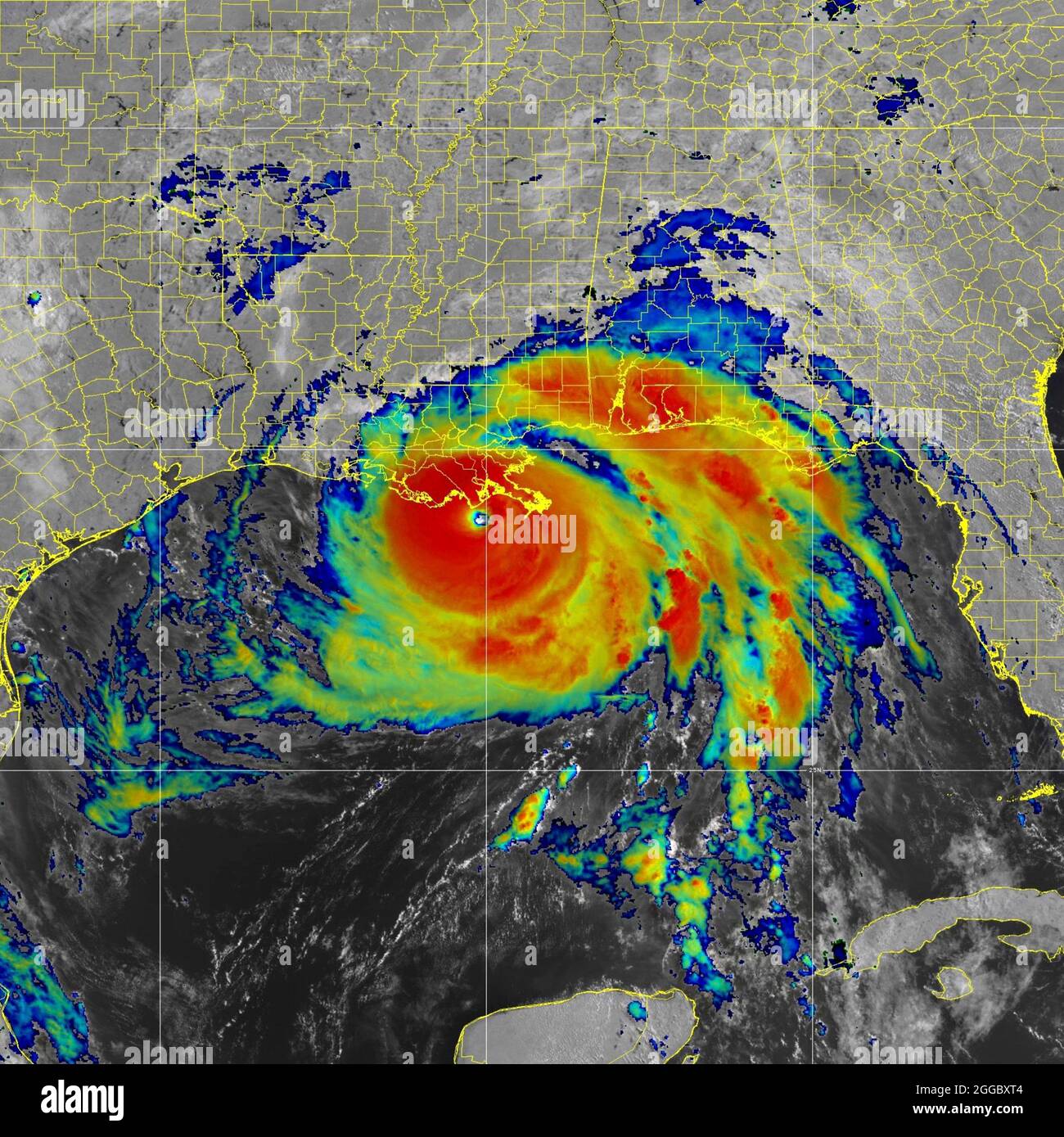
NASA MODIS satellite image showing Hurricane Ida, a category 4 storm as strikes the coast of lower Louisiana August 29, 2021 east of New Orleans. Ida is packing winds of 150 mph made landfall 16-years ago to the day of Hurricane Katrina. Credit: Planetpix/Alamy Live News
RMID:Image ID:2GGBXT4
Image details
Contributor:
NOAA / Alamy Stock PhotoImage ID:
2GGBXT4File size:
37.6 MB (1.9 MB Compressed download)Releases:
Model - no | Property - noDo I need a release?Dimensions:
3627 x 3626 px | 30.7 x 30.7 cm | 12.1 x 12.1 inches | 300dpiDate taken:
29 August 2021Location:
Louisiana, USAMore information:
This image is a public domain image, which means either that copyright has expired in the image or the copyright holder has waived their copyright. Alamy charges you a fee for access to the high resolution copy of the image.
This image could have imperfections as it’s either historical or reportage.