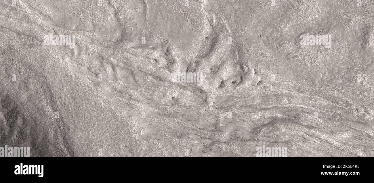
Martian landscape. This HiRISE image shows landforms on the surface of Mars. Channels in Phlegra Montes. Also visible in a Context Camera image, pictures like this can help us understand the fluvial and climate history of ancient Mars. Image shows terrain less than 5 km (3 mi) across; taken 296 km (184 mi) above the surface of Mars. A unique optimised version of NASA imagery. Credit: NASA/JPL/UArizona
RMID:Image ID:2K5E4RE
Image details
Contributor:
J Marshall - Tribaleye Images / Alamy Stock PhotoImage ID:
2K5E4REFile size:
126.3 MB (11 MB Compressed download)Releases:
Model - no | Property - noDo I need a release?Dimensions:
10240 x 4310 px | 86.7 x 36.5 cm | 34.1 x 14.4 inches | 300dpiDate taken:
21 November 2018Location:
Mars, Phlegra MontesPhotographer:
NASA / digitaleye