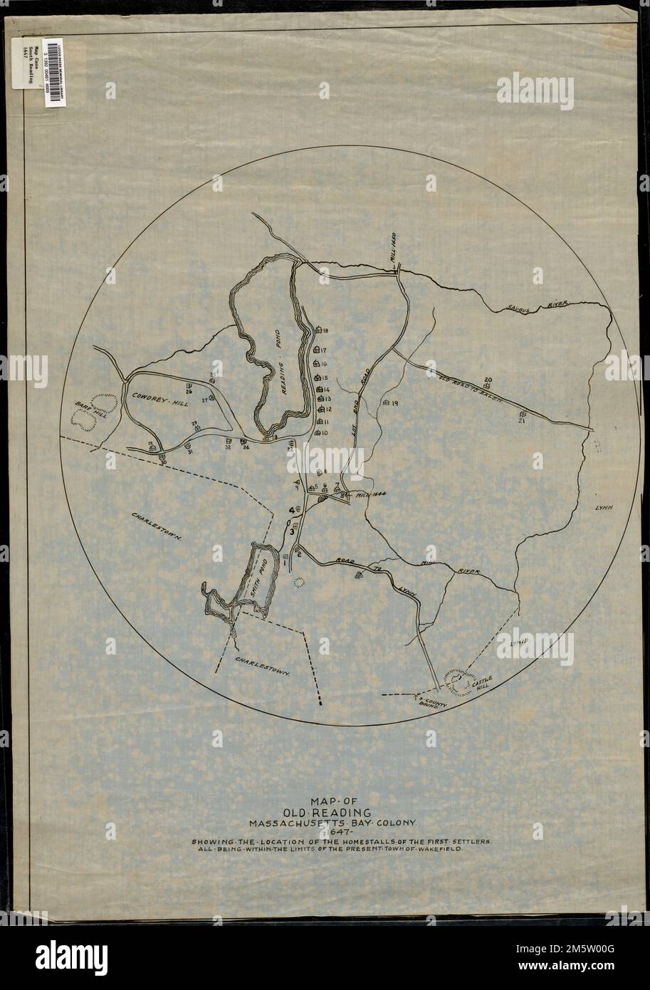
Map of old Reading, Massachusetts Bay Colony, 1647. Map depicts the entire town of South Reading (Wakefield) as it was in 1647, showing streets, bodies of water, hills, and locations of original settlers' homes. "Showing the location of the homestalls of the first settlers all being within the limits of the present town of Wakefield." -- Text from bottom of map.... , Massachusetts , Middlesex ,county , Wakefield
RMID:Image ID:2M5W00G
Image details
Contributor:
LM/BT / Alamy Stock PhotoImage ID:
2M5W00GFile size:
134.2 MB (5.9 MB Compressed download)Releases:
Model - no | Property - noDo I need a release?Dimensions:
5742 x 8171 px | 48.6 x 69.2 cm | 19.1 x 27.2 inches | 300dpiMore information:
This image is a public domain image, which means either that copyright has expired in the image or the copyright holder has waived their copyright. Alamy charges you a fee for access to the high resolution copy of the image.
This image could have imperfections as it’s either historical or reportage.