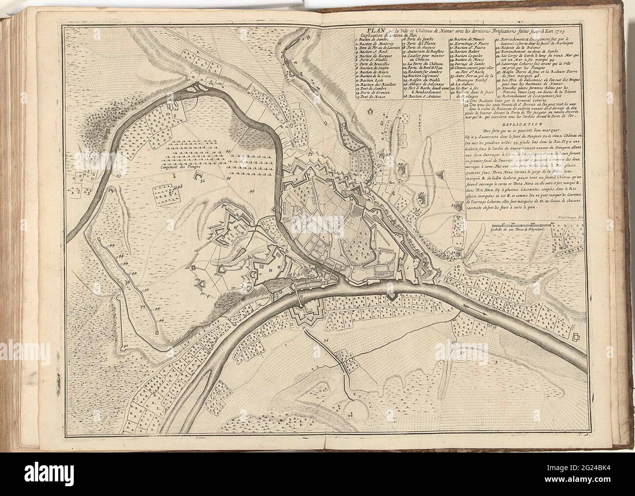
Map of Namur, 1709; Plan De La Ville et Château de Namur AVEC Les Dernieres Fortifications Faites Jusqu à l'an 1709. Map of Namur with the reinforcements up to the year 1709. At the top right The legend 1-53 and a statement. Part of a bundled collection of plans of battles and cities renowned in the Spanish succession war.
RMID:Image ID:2G24BK4
Image details
Contributor:
BTEU/RKMLGE / Alamy Stock PhotoImage ID:
2G24BK4File size:
12.7 MB (1 MB Compressed download)Releases:
Model - no | Property - noDo I need a release?Dimensions:
2500 x 1780 px | 21.2 x 15.1 cm | 8.3 x 5.9 inches | 300dpiDate taken:
7 June 2021More information:
This image is a public domain image, which means either that copyright has expired in the image or the copyright holder has waived their copyright. Alamy charges you a fee for access to the high resolution copy of the image.
This image could have imperfections as it’s either historical or reportage.