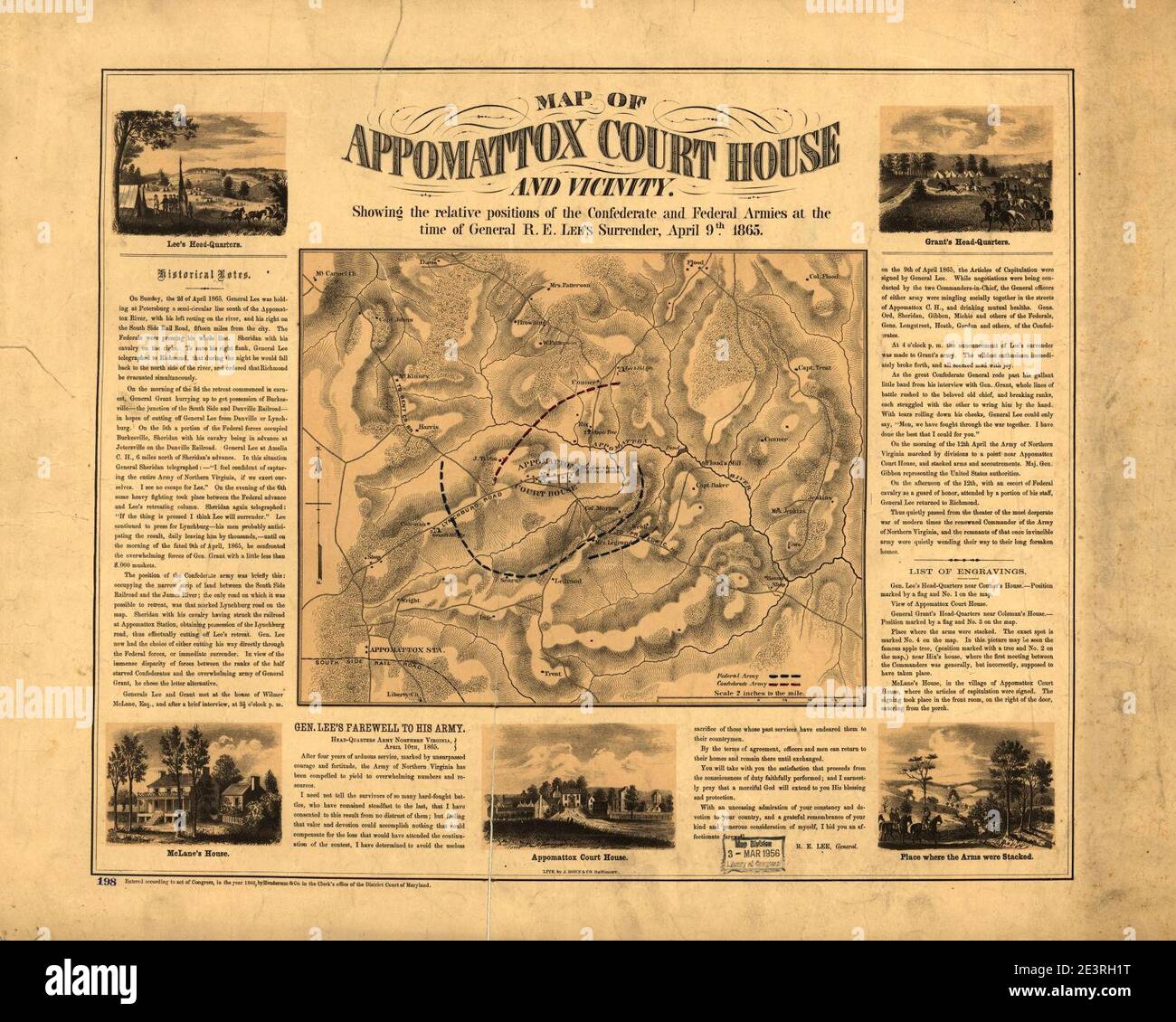
Map of Appomattox Court House and vicinity. Showing the relative positions of the Confederate and Federal Armies at the time of General R. E. Lee's surrender, April 9th 1865.
RMID:Image ID:2E3RH1T
Image details
Contributor:
Jimlop collection / Alamy Stock PhotoImage ID:
2E3RH1TFile size:
5.7 MB (488.9 KB Compressed download)Releases:
Model - no | Property - noDo I need a release?Dimensions:
1581 x 1265 px | 26.8 x 21.4 cm | 10.5 x 8.4 inches | 150dpiMore information:
This image could have imperfections as it’s either historical or reportage.