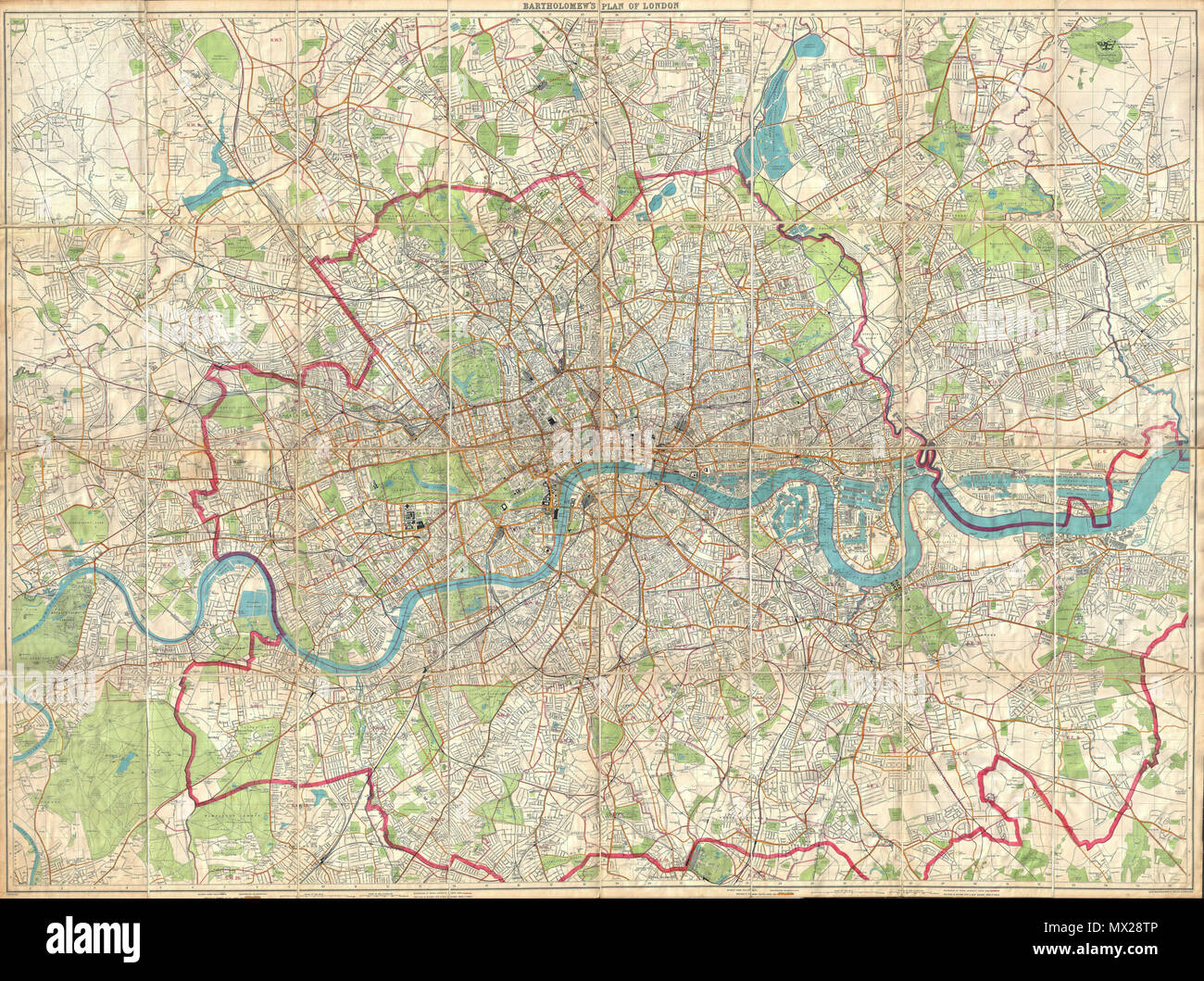
. London Fire Brigade Instructional Map. - Bartholomew's Plan of London. English: An enormously proportioned and extremely unusual map of London, England prepared by John Bartholomew. Covers the entire city of London from Kenton in the northwest, to Richmond Park in the southwest, to Hospital Hill in the northeast and Longlands in the southeast. Offers extraordinary detail freely labeling individual buildings, streets, and waterways throughout London. Prepared as a “London Fire Brigade Instructional Map” with the area of London patrolled by the fire brigades outlined in red. Probably not orig
Image details
Contributor:
The Picture Art Collection / Alamy Stock PhotoImage ID:
MX28TPFile size:
14.3 MB (1.9 MB Compressed download)Releases:
Model - no | Property - noDo I need a release?Dimensions:
2588 x 1931 px | 21.9 x 16.3 cm | 8.6 x 6.4 inches | 300dpiMore information:
This image is a public domain image, which means either that copyright has expired in the image or the copyright holder has waived their copyright. Alamy charges you a fee for access to the high resolution copy of the image.
This image could have imperfections as it’s either historical or reportage.
. London Fire Brigade Instructional Map. - Bartholomew's Plan of London. English: An enormously proportioned and extremely unusual map of London, England prepared by John Bartholomew. Covers the entire city of London from Kenton in the northwest, to Richmond Park in the southwest, to Hospital Hill in the northeast and Longlands in the southeast. Offers extraordinary detail freely labeling individual buildings, streets, and waterways throughout London. Prepared as a “London Fire Brigade Instructional Map” with the area of London patrolled by the fire brigades outlined in red. Probably not originally a fire brigade map, but adopted by the fire brigade commanders from Bartholomew’s Plan of London , the best available at the time. Undated, but fits with the style and layout of the late 19th century. A rare and magnificent piece of London history. . circa 1899(undated) 11 1899 Bartholomew Fire Brigade Map of London, England - Geographicus - London-bartholomew-1899