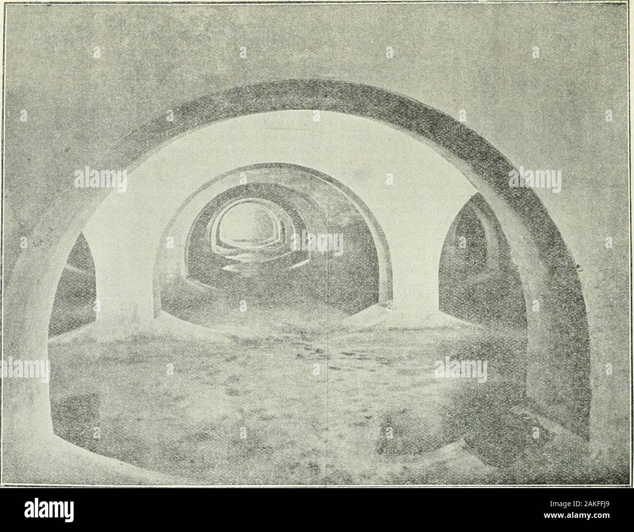
The Surveyor and municipal engineer . daily, and a registerof the whole kept for reference. Tho level of the groundround well is 2d8o ft. above ordnance datum, the bottom oftho tank is 2525 ft. above ordnance datum, tiie surface of thestream 2525ft. above ordnance datum, and tho surface ofthe water in canal 256 ft. above ordnance datum. Tho reservoir is situated at Goldthorn Hill, a distance of6,617 yaids from the pumping station at thoBratch; thobottom of tho reservoir is 595 ft. above onlnance datum ; thoinlet from the rising main being 597 ft. above ordnancedotum, tho outlet to Bilston 5953
Image details
Contributor:
The Reading Room / Alamy Stock PhotoImage ID:
2AKFFJ9File size:
7.1 MB (475.3 KB Compressed download)Releases:
Model - no | Property - noDo I need a release?Dimensions:
1801 x 1387 px | 30.5 x 23.5 cm | 12 x 9.2 inches | 150dpiMore information:
This image is a public domain image, which means either that copyright has expired in the image or the copyright holder has waived their copyright. Alamy charges you a fee for access to the high resolution copy of the image.
This image could have imperfections as it’s either historical or reportage.
The Surveyor and municipal engineer . daily, and a registerof the whole kept for reference. Tho level of the groundround well is 2d8o ft. above ordnance datum, the bottom oftho tank is 2525 ft. above ordnance datum, tiie surface of thestream 2525ft. above ordnance datum, and tho surface ofthe water in canal 256 ft. above ordnance datum. Tho reservoir is situated at Goldthorn Hill, a distance of6, 617 yaids from the pumping station at thoBratch; thobottom of tho reservoir is 595 ft. above onlnance datum ; thoinlet from the rising main being 597 ft. above ordnancedotum, tho outlet to Bilston 59533 ft. above ordnance datum, the top water level 607 ft. above ordnance datum, and thesurface of tho ground on the top is 011-75 ft. above oninaucodatum. It is a covered service reservoir only, coiistrnotedentirely of cement concrete with a floated face ; it is 110 ft.9 in. by 106 ft., divided into niiio compartments by eightcross walls, 2 ft. thick, and covered with semicular arches, 418 THE SURVEYOR AND MUNICIPAL [September so, 1898.. BiLSTON Waterworks: View of the Service Reservoir. tlie croas walls themselves beiiipj each uiercetl with ten suit-able openiiiga ; the drains run in the cross walls, and are allcollected and cnnnectirg to the cleansing pond; twenty-sevenCrefjeens air-inlets are provided, and a by-pass, so that thewater can be pumped direct into the mains whilst the reser-voir is beinj^ cleaned out, &c. The bottom is 2 fr. thick, andthe sides and ends taper from 3 ft. 6 in. at the bottom to 2 ft.at the top; an overflow and draw-off pipe is also fi.xed andconnected to the cleansing pond, and the necessary manholes, ladders and valve chambers are also fixed. The concreteused consisted of six parts by measure of mixed stone andsand to one of cement, the cement being fresh burnt finelyground Portland, weighijie 1161b. per striked bushel whenfilled from a hopper with a fall of not more than 1 ft., and tostand 3.501b. to the square inch when tested on a section of2^- squ