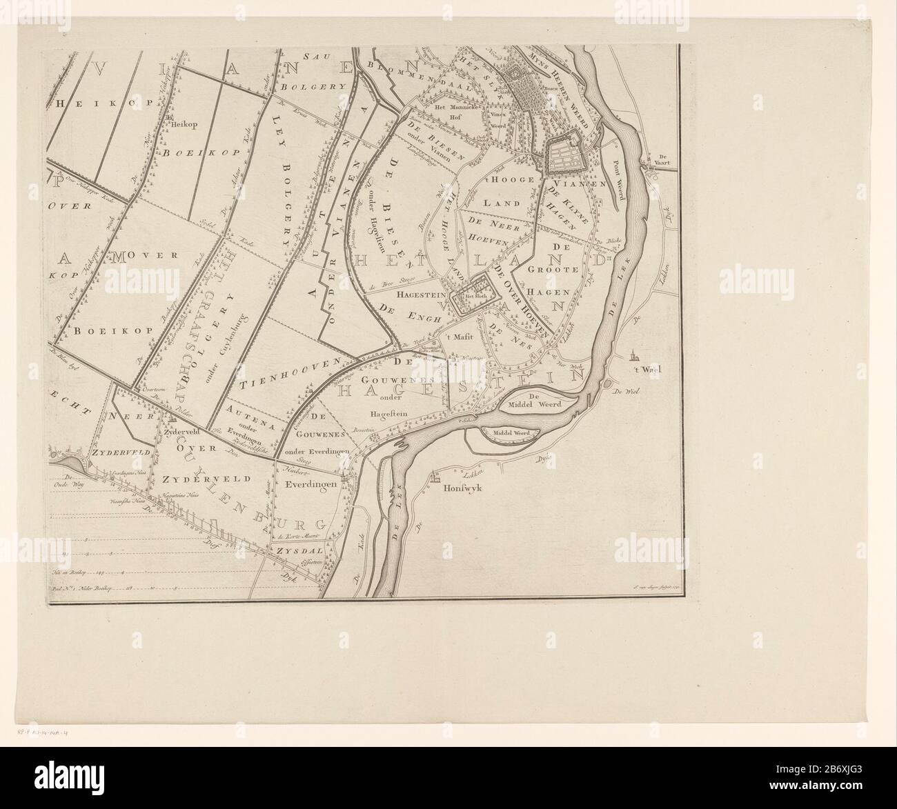
Kaart van de Vijfheerenlanden (deel rechtsonder) Nieuwe kaart van de Vyf Heeren Landen gelegen tusschen den Dief en Zouwen Dyk Part (right) a map of the Vijfheerenlanden consisting of four parts. Orientation: north rechts. Manufacturer : printmaker Jan van Hunting (listed building) Publisher: C. Mortar & J. Covens & Zoon Place manufacture: Amsterdam Date: 1741 and / or 1783 - 1787 Material: paper Technique: engra (printing process) Dimensions: plate edge : h 435 mm × W 508 mm Subject: maps of separate countries or regions polder, reclaimed land where: Vijfheerenlanden
RMID:Image ID:2B6XJG3
Image details
Contributor:
Art World / Alamy Stock PhotoImage ID:
2B6XJG3File size:
7.2 MB (325.8 KB Compressed download)Releases:
Model - no | Property - noDo I need a release?Dimensions:
1732 x 1443 px | 29.3 x 24.4 cm | 11.5 x 9.6 inches | 150dpiMore information:
This image is a public domain image, which means either that copyright has expired in the image or the copyright holder has waived their copyright. Alamy charges you a fee for access to the high resolution copy of the image.
This image could have imperfections as it’s either historical or reportage.