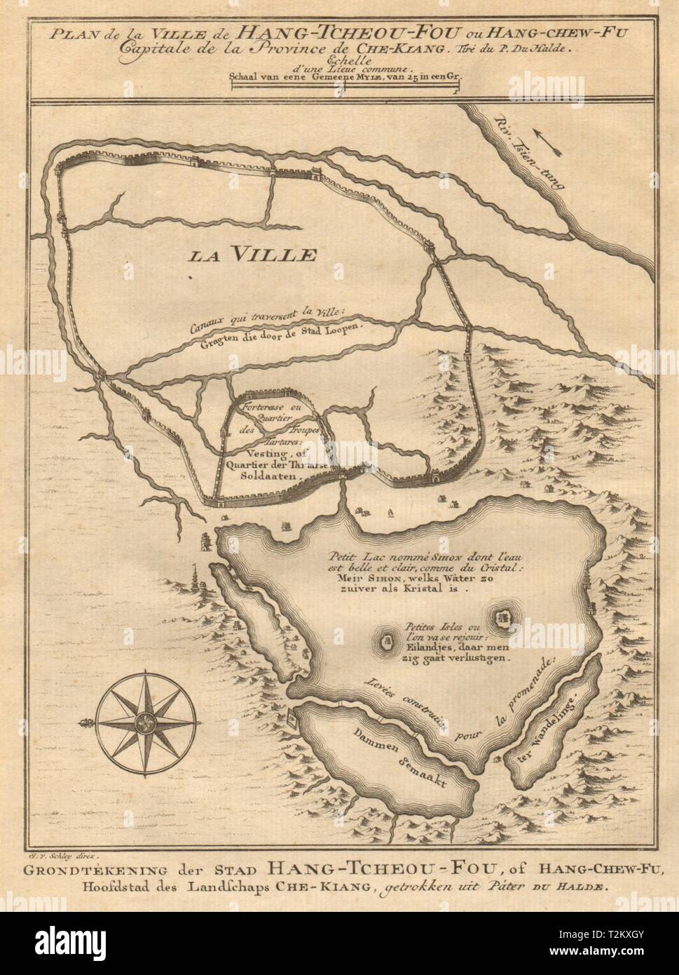
'Hang-Tcheou-Fou'. Hangzhou city plan, Zhejiang, China. BELLIN/SCHLEY 1749 map
Image details
Contributor:
Antiqua Print Gallery / Alamy Stock PhotoImage ID:
T2KXGYFile size:
15 MB (730.7 KB Compressed download)Releases:
Model - no | Property - noDo I need a release?Dimensions:
1981 x 2655 px | 16.8 x 22.5 cm | 6.6 x 8.9 inches | 300dpiDate taken:
1749Location:
ChinaMore information:
This image could have imperfections as it’s either historical or reportage.
Plan de la Ville de Hang-Tcheou-Fou, ou Hang-Chew-fu, Capitale de la Province de Che-Kiang [Plan of the City of Hangzhou, capital of Chekiang/Zhejiang Province ]. Artist/engraver/cartographer: Jakob van der Schley & Jacques Nicolas Bellin. Provenance: "Histoire Générale des Voyages, ou nouvelle collection de toutes les relations de voyages par mer et par terre", nouvelle edition … dont les figures & les cartes ont été gravées par & sous le direction de J. Vander Schley, elève distingué du célèbre Picart Le Romain. A La Haye, Chez Pierre de Hondt, avec Privilége de sa Majesté Impériale & de Nos Seignuers les Etats de Hollande & de West-Frise. Type: Antique copperplate map. The West Lake is shown at the bottom of the map, which is orientated towards the east