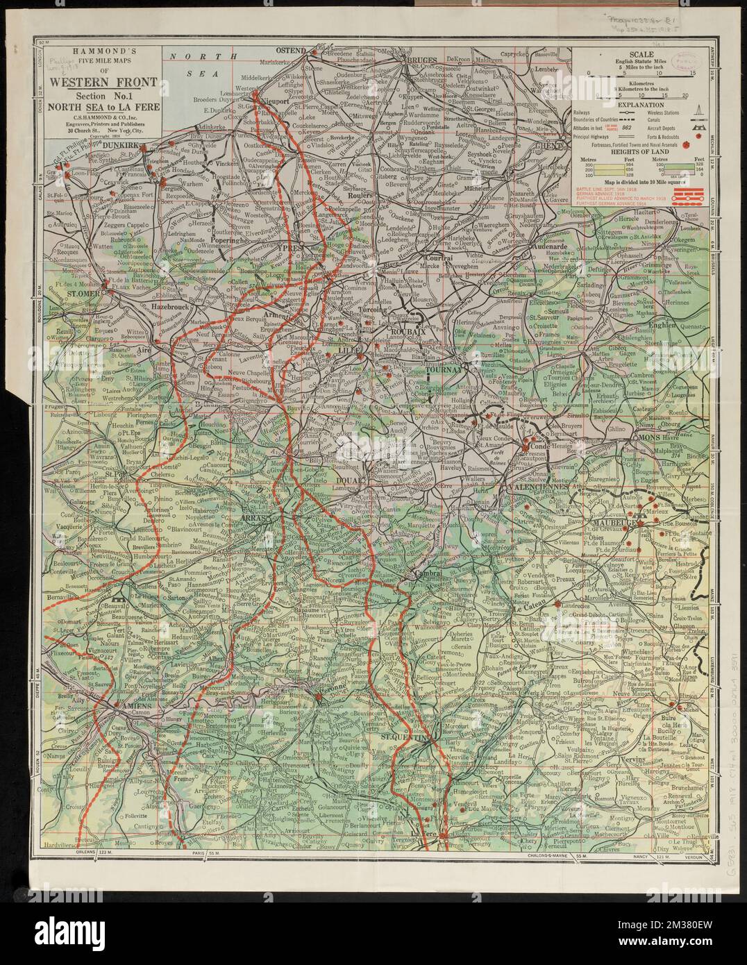
Hammond's five mile maps of western front , World War, 1914-1918, Campaigns, France, Maps, France, Maps Norman B. Leventhal Map Center Collection
RMID:Image ID:2M380EW
Image details
Contributor:
piemags/DCM / Alamy Stock PhotoImage ID:
2M380EWFile size:
105 MB (7.1 MB Compressed download)Releases:
Model - no | Property - noDo I need a release?Dimensions:
5513 x 6658 px | 46.7 x 56.4 cm | 18.4 x 22.2 inches | 300dpiMore information:
This image is a public domain image, which means either that copyright has expired in the image or the copyright holder has waived their copyright. Alamy charges you a fee for access to the high resolution copy of the image.
This image could have imperfections as it’s either historical or reportage.