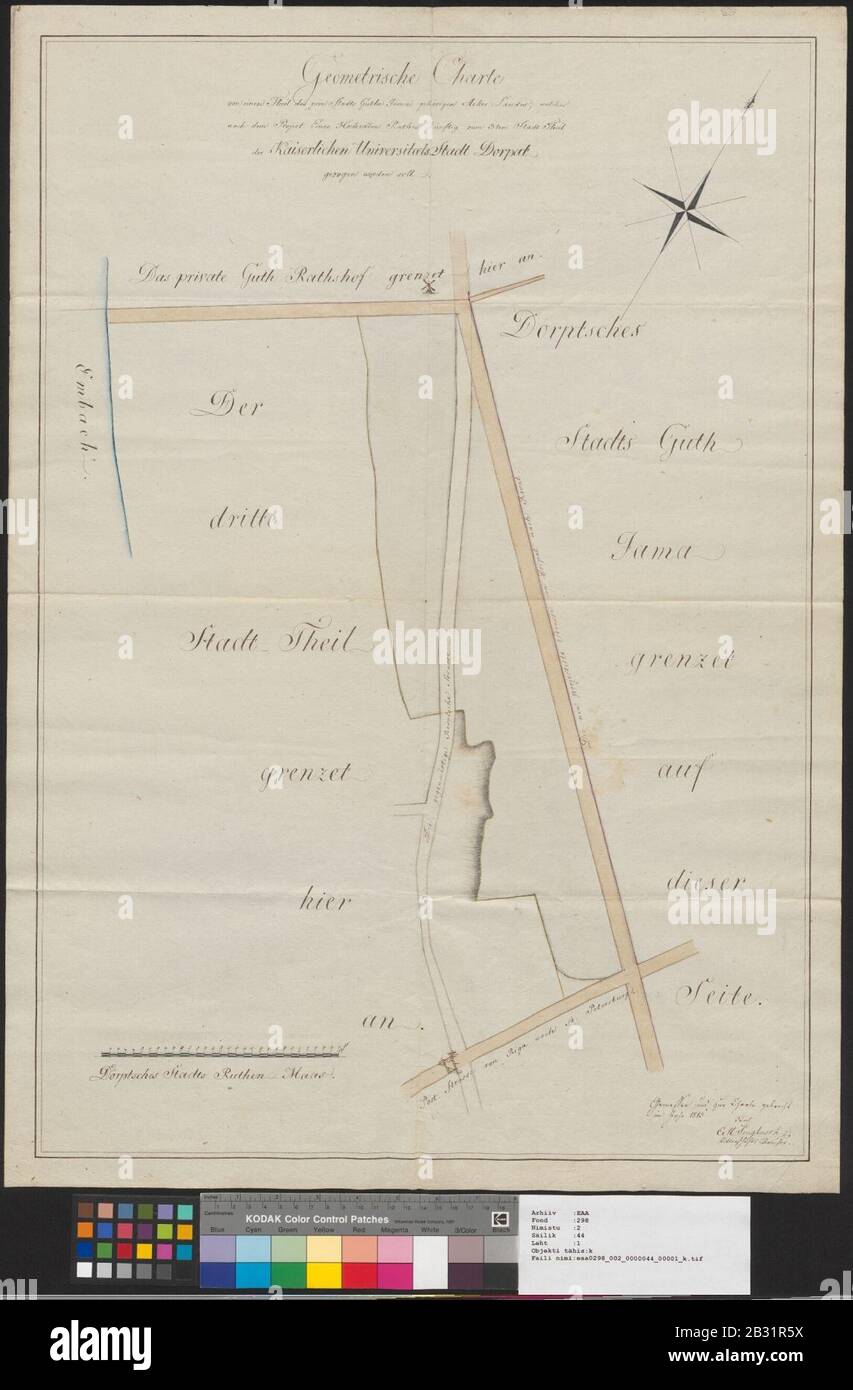
Geometrische Charte von einen Theil des zum Stadt Guthe Jama gehörigen Acker Landes, welches nach dem Project Eines Hochedlen Rathes künftig zum 3-tem Stadt Theil der Kaiserlischen Universitaets-Stadt Dorpat gezogen worden soll.
RMID:Image ID:2B31R5X
Image details
Contributor:
Yogi Black / Alamy Stock PhotoImage ID:
2B31R5XFile size:
5.7 MB (195 KB Compressed download)Releases:
Model - no | Property - noDo I need a release?Dimensions:
1146 x 1745 px | 19.4 x 29.5 cm | 7.6 x 11.6 inches | 150dpiMore information:
This image is a public domain image, which means either that copyright has expired in the image or the copyright holder has waived their copyright. Alamy charges you a fee for access to the high resolution copy of the image.
This image could have imperfections as it’s either historical or reportage.