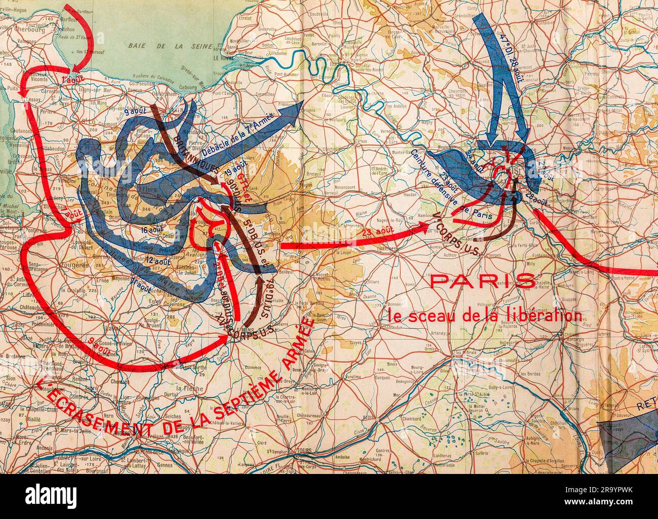
French World War 2 book map illustration printed in 1946 showing Allied and Axis army movements on French territory during 1944.
RMID:Image ID:2R9YPWK
Image details
Contributor:
Ed Buziak / Alamy Stock PhotoImage ID:
2R9YPWKFile size:
51.5 MB (5 MB Compressed download)Releases:
Model - no | Property - noDo I need a release?Dimensions:
5000 x 3603 px | 42.3 x 30.5 cm | 16.7 x 12 inches | 300dpiDate taken:
29 June 2023Location:
France.