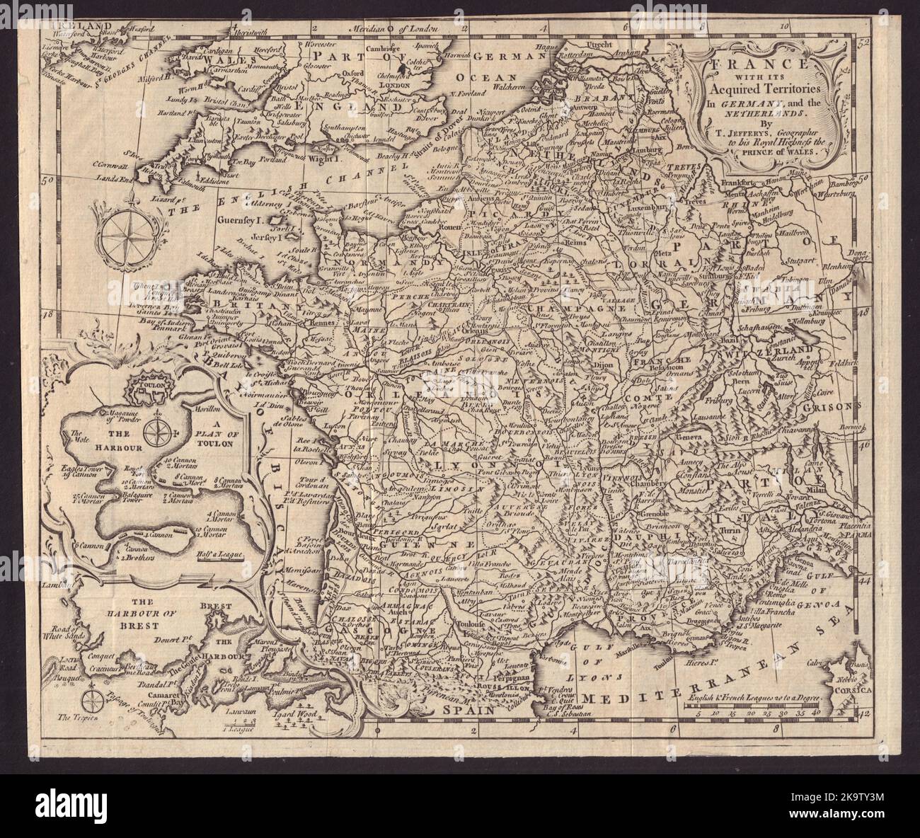
France with its acquired territories in Germany & Netherlands. JEFFERYS 1747 map
RFID:Image ID:2K9TY3M
Image details
Contributor:
Antiqua Print Gallery / Alamy Stock PhotoImage ID:
2K9TY3MFile size:
124.5 MB (7 MB Compressed download)Releases:
Model - no | Property - noDo I need a release?Dimensions:
7190 x 6052 px | 60.9 x 51.2 cm | 24 x 20.2 inches | 300dpiDate taken:
1747Location:
FranceMore information:
This image could have imperfections as it’s either historical or reportage.
France with its Acquired Territories in Germany, and the Netherlands by T. Jefferys, Geographer to his Royal Highness the Prince of Wales. Artist/engraver/cartographer: T. Jefferys sculp. Provenance: "Gentleman's Magazine and Historical Chronicle", by Sylvanus Urban, Gent. London: Printed by Edw. Cave at St. John's Gate . Type: Antique copperplate map.