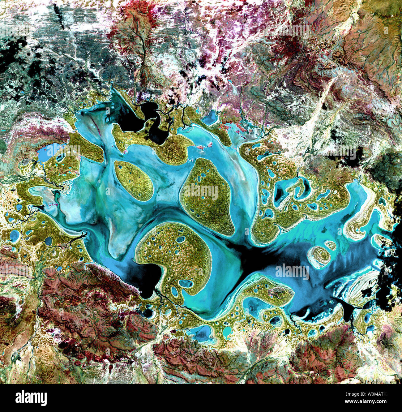
Ephemeral Lake Carnegie, in Western Australia, is shown filled with water after a period of significant rainfall. In dry years, it is reduced to a muddy marsh. This image was acquired by Landsat 7's Enhanced Thematic Mapper plus sensor on May 19, 1999. It is a false-color composite image made using shortwave infrared, infrared and red wavelengths. The image was sharpened using the sensor's panchromatic band. (UPI Photo/NASA)
RMID:Image ID:W0MATH
Image details
Contributor:
UPI / Alamy Stock PhotoImage ID:
W0MATHFile size:
10.9 MB (1.5 MB Compressed download)Releases:
Model - no | Property - noDo I need a release?Dimensions:
2000 x 1911 px | 33.9 x 32.4 cm | 13.3 x 12.7 inches | 150dpiDate taken:
4 May 2007Photographer:
NASAMore information:
This image could have imperfections as it’s either historical or reportage.