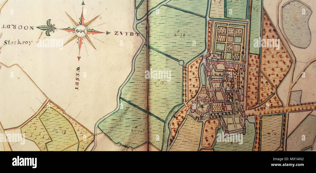
. English: Fragment of a map by Peter Meysman, dated 1669, that shows Herkenrode Abbey near Hasselt, nowadays in Belgium and at that time part of the principality of Liege. Español: Fragmento de un mapa realizado por Peter Meysman y fechado en 1669 que muestra la abadía de Herkenrode, cerca de Hasselt (ahora Bélgica, por aquel entonces parte del principado de Lieja). 10 September 2016, 19:01:39. Peter Meysman (1669) 276 Herkenrode 1669 Peter Meysman
RMID:Image ID:MX1AN2
Image details
Contributor:
The Picture Art Collection / Alamy Stock PhotoImage ID:
MX1AN2File size:
14.3 MB (896.9 KB Compressed download)Releases:
Model - no | Property - noDo I need a release?Dimensions:
3229 x 1548 px | 27.3 x 13.1 cm | 10.8 x 5.2 inches | 300dpiDate taken:
10 September 2016More information:
This image is a public domain image, which means either that copyright has expired in the image or the copyright holder has waived their copyright. Alamy charges you a fee for access to the high resolution copy of the image.
This image could have imperfections as it’s either historical or reportage.