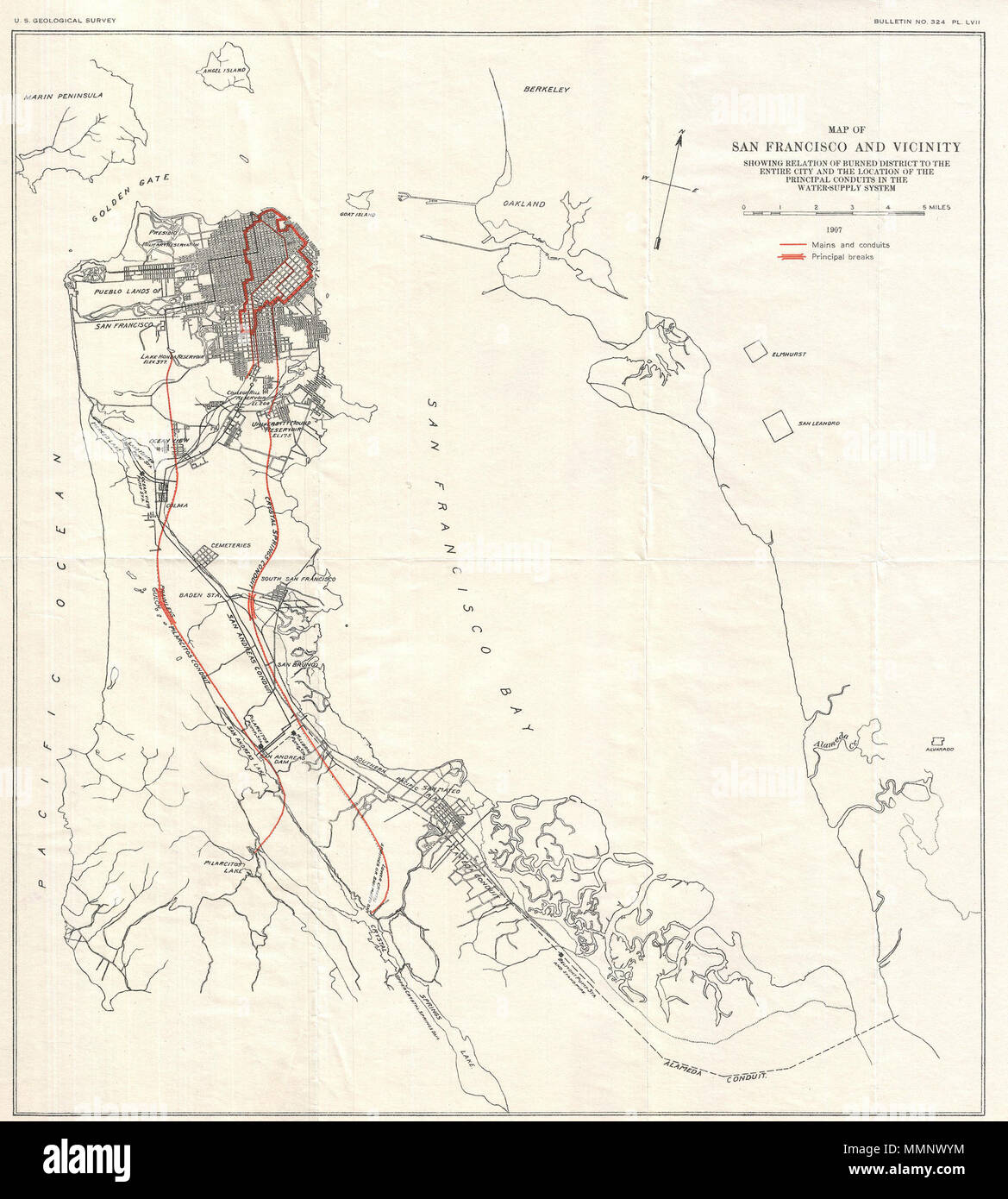
. English: An unusual map of San Francisco Peninsula and part of San Francisco Bay dating to 1907. This map was published by the U.S. Geological Survey following the terrible San Francisco Earthquake and Fire of 1806. This natural disaster, comparable to the devastation wrought by Hurricane Katrina, is considered the largest is California History. This map highlights the developed parts of San Francisco most damaged by the fire in red ink. It also shows the water conduits that supply the city. Published in the U.S. Geological Survey's 1907 report on the San Francisco Earthquake and Fire. Map
Image details
Contributor:
The Picture Art Collection / Alamy Stock PhotoImage ID:
MMNWYMFile size:
14.3 MB (802.2 KB Compressed download)Releases:
Model - no | Property - noDo I need a release?Dimensions:
2120 x 2357 px | 35.9 x 39.9 cm | 14.1 x 15.7 inches | 150dpiMore information:
This image is a public domain image, which means either that copyright has expired in the image or the copyright holder has waived their copyright. Alamy charges you a fee for access to the high resolution copy of the image.
This image could have imperfections as it’s either historical or reportage.
. English: An unusual map of San Francisco Peninsula and part of San Francisco Bay dating to 1907. This map was published by the U.S. Geological Survey following the terrible San Francisco Earthquake and Fire of 1806. This natural disaster, comparable to the devastation wrought by Hurricane Katrina, is considered the largest is California History. This map highlights the developed parts of San Francisco most damaged by the fire in red ink. It also shows the water conduits that supply the city. Published in the U.S. Geological Survey's 1907 report on the San Francisco Earthquake and Fire. Map of San Francisco and Vicinity Showing Relation of Burned District to the Entire City and the Location of the Principal Conduits in the Water-Suppy System.. 1907 (dated). 12 1907 Geological Survey Map of San Francisco Peninsula after 1906 Earthquake - Geographicus - Sanfrancisco-geologicalsurvey-1906