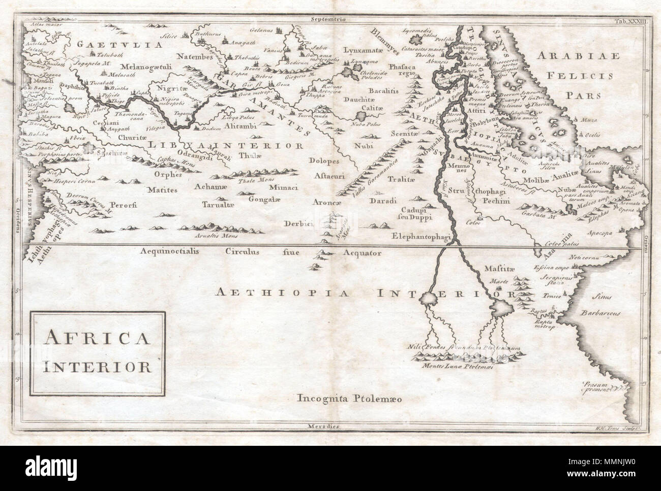
. English: A very curious map of central Africa dating to approximately 1730. Covers the mid-section of Africa roughly from the Gulf of Guinea and the Atlantic eastward to the Red Sea and the horn. Extends southward as far as modern day Tanzania. Full of curious and often spurious information. Identifies the kingdoms of the Axuxmites in modern day Ethiopia, as well as the Nubians, the Amanites, and many other mysterious peoples. In the west the map, the Niger River begins and ends without a source or oceanic outlet. Further east, the map follows the course of the Nile river southward, past th
Image details
Contributor:
The Picture Art Collection / Alamy Stock PhotoImage ID:
MMNJW0File size:
14.3 MB (859.9 KB Compressed download)Releases:
Model - no | Property - noDo I need a release?Dimensions:
2721 x 1837 px | 23 x 15.6 cm | 9.1 x 6.1 inches | 300dpiMore information:
This image is a public domain image, which means either that copyright has expired in the image or the copyright holder has waived their copyright. Alamy charges you a fee for access to the high resolution copy of the image.
This image could have imperfections as it’s either historical or reportage.
. English: A very curious map of central Africa dating to approximately 1730. Covers the mid-section of Africa roughly from the Gulf of Guinea and the Atlantic eastward to the Red Sea and the horn. Extends southward as far as modern day Tanzania. Full of curious and often spurious information. Identifies the kingdoms of the Axuxmites in modern day Ethiopia, as well as the Nubians, the Amanites, and many other mysterious peoples. In the west the map, the Niger River begins and ends without a source or oceanic outlet. Further east, the map follows the course of the Nile river southward, past the lands of the Elephantophagi, to two mysterious lakes. These great lakes, at the foot of the mountains of the moon, were part of a long enduring myth in African cartography that dates to the works of Claudius Ptolemy. In fact, though issued nearly 1600 years after Ptolemy’s death, most of the information here is based directly on his work. Cartographically this map is very similar to Culver’s map of the same name issued in 1736. Africa Interior. 1729. 1730 Toms Map of Central Africa - Geographicus - Africa-toms-1730