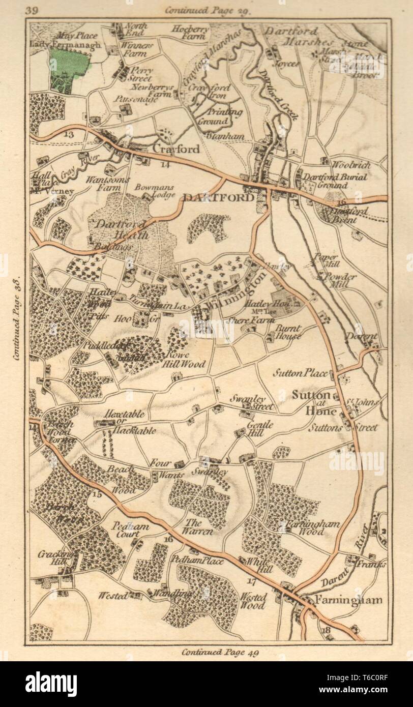
DARTFORD.Crayford,Bexley,Sutton at Hone,Farningham,Wilmington,Swanley 1811 map
Image details
Contributor:
Antiqua Print Gallery / Alamy Stock PhotoImage ID:
T6C0RFFile size:
6.5 MB (406.4 KB Compressed download)Releases:
Model - no | Property - noDo I need a release?Dimensions:
1190 x 1903 px | 20.2 x 32.2 cm | 7.9 x 12.7 inches | 150dpiDate taken:
1811Location:
KentMore information:
This image could have imperfections as it’s either historical or reportage.
Artist/engraver/cartographer: J Cary. Provenance: "Cary's actual survey of the country fifteen miles round London"; On a scale of one inch to a mile. Wherein the roads, rivers, woods and commons as well as every market town, village &c. are distinguished; and every seat shewn with the name of the possessor. London: printed for J. Cary, engraver, map and print seller, no 181 Strand. Published as the Act directs, July 1st 1811. [Cary's survey of 15 miles round London]. Type: Antique hand coloured engraved map. Scale one inch to a mile. [Map section 39. Continuation to the north on map section 29. Continuation to the south on map section 49. Continuation to the west on map section 38. Continuation to the east on map section 40]