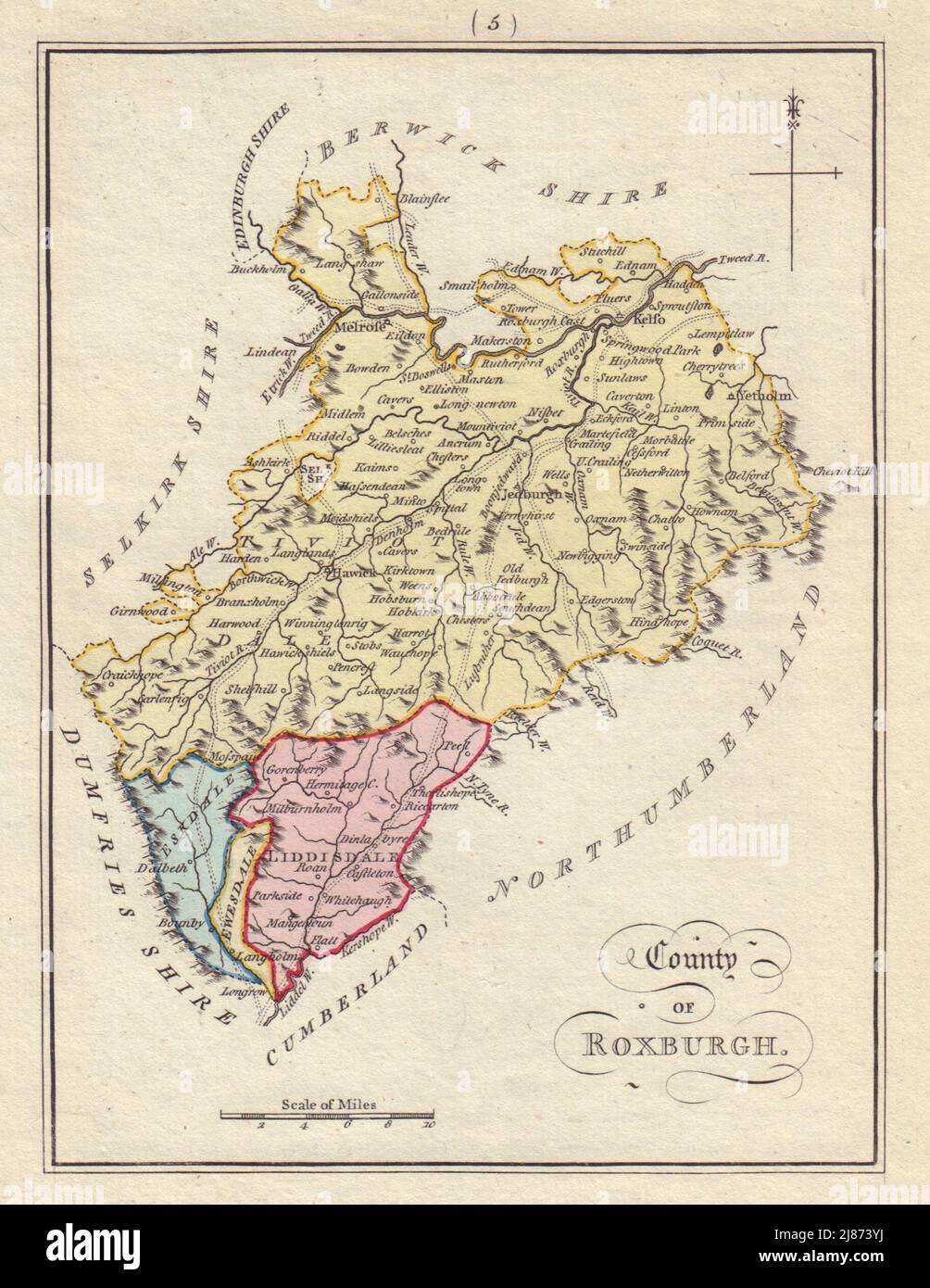
County of Roxburgh. Roxburghshire. SAYER / ARMSTRONG 1794 old antique map
RFID:Image ID:2J873YJ
Image details
Contributor:
Antiqua Print Gallery / Alamy Stock PhotoImage ID:
2J873YJFile size:
12.4 MB (781.6 KB Compressed download)Releases:
Model - no | Property - noDo I need a release?Dimensions:
1829 x 2366 px | 31 x 40.1 cm | 12.2 x 15.8 inches | 150dpiDate taken:
1794Location:
ScotlandMore information:
This image could have imperfections as it’s either historical or reportage.
County of Roxburgh. Artist/engraver/cartographer: Engraved by Harry Ashby. First published by Robert Sayer & John Bennett in Mostyn John Armstrong's "Scotch Atlas" 1777. Provenance: "Scotch Atlas or Description of the Kingdom of Scotland": Divided Into Counties, with the Subdivisions of Sherifdoms; Published 12th May 1794 by Laurie & Whittle. Type: Antique copperplate hand-coloured map.