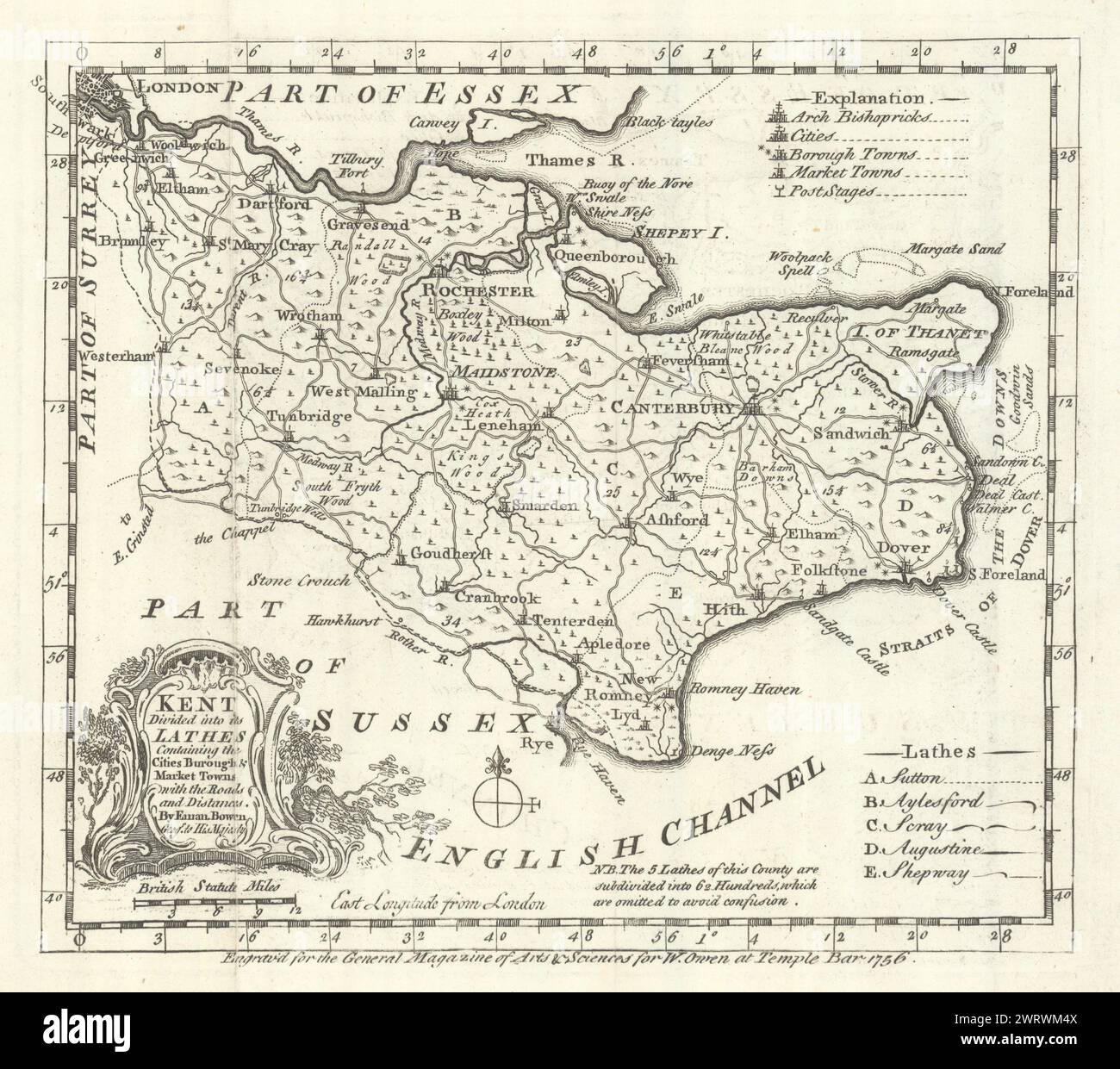
County map of "Kent Divided into its Lathes…" by Emanuel Bowen 1756 old
RFID:Image ID:2WRWM4X
Image details
Contributor:
Antiqua Print Gallery / Alamy Stock PhotoImage ID:
2WRWM4XFile size:
64.8 MB (3.6 MB Compressed download)Releases:
Model - no | Property - noDo I need a release?Dimensions:
5055 x 4478 px | 42.8 x 37.9 cm | 16.9 x 14.9 inches | 300dpiDate taken:
1756Location:
KentMore information:
This image could have imperfections as it’s either historical or reportage.
Kent Divided into its Lathes Containing the Cities Burough & Market Towns with Roads and Distances. By Eman. Bowen Geographer to His Majesty. Artist/engraver/cartographer: Emanuel Bowen. Provenance: "General Magazine of Arts & Sciences", Benjamin Martin, Published by W. Owen, March 1756. Type: Antique copperplate county map.