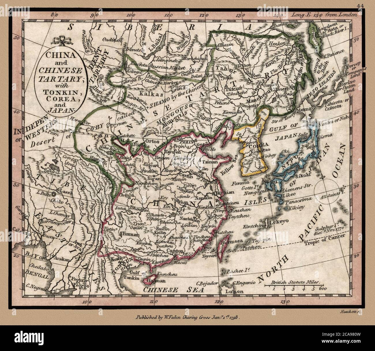
"China and Chinese Tartary, with Tonkin, Corea, and Japan." Map shows political borders and important landmarks. This is a beautifully detailed historic map reproduction. Original from a British atlas published by famed cartographer William Faden was created circa 1798.
RMID:Image ID:2CA980W
Image details
Contributor:
Phil Cardamone / Alamy Stock PhotoImage ID:
2CA980WFile size:
22.7 MB (2 MB Compressed download)Releases:
Model - no | Property - noDo I need a release?Dimensions:
3028 x 2625 px | 25.6 x 22.2 cm | 10.1 x 8.8 inches | 300dpiDate taken:
4 August 2020More information:
This image is a public domain image, which means either that copyright has expired in the image or the copyright holder has waived their copyright. Alamy charges you a fee for access to the high resolution copy of the image.
This image could have imperfections as it’s either historical or reportage.
This restored, detailed reproduction brings out many details and landmarks, making this map a great historical reference. I have selected interesting, old graphic images for digital restoration and editing. The images were adjusted and brightened-not merely scanned-to make the images suitable for display and other purposes. © 2020 for this restored reproduction.