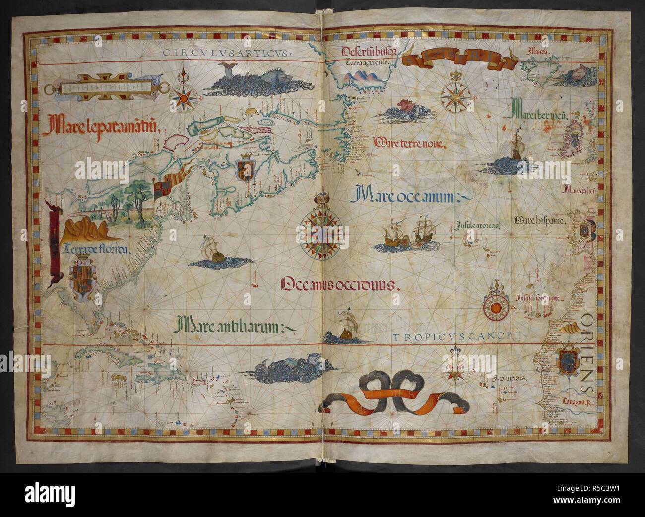
Chart of the North Atlantic Ocean from Florida on the west to Iceland, Ireland and the Iberian peninsula on the east. Queen Mary Atlas. 1558. Source: Add. 5415 A, ff.19v-20. Author: Homem, Diego.
RMID:Image ID:R5G3W1
Image details
Contributor:
Album / British Library / Alamy Stock PhotoImage ID:
R5G3W1File size:
89.1 MB (3.7 MB Compressed download)Releases:
Model - no | Property - noDo I need a release?Dimensions:
6518 x 4777 px | 55.2 x 40.4 cm | 21.7 x 15.9 inches | 300dpiMore information:
This image could have imperfections as it’s either historical or reportage.