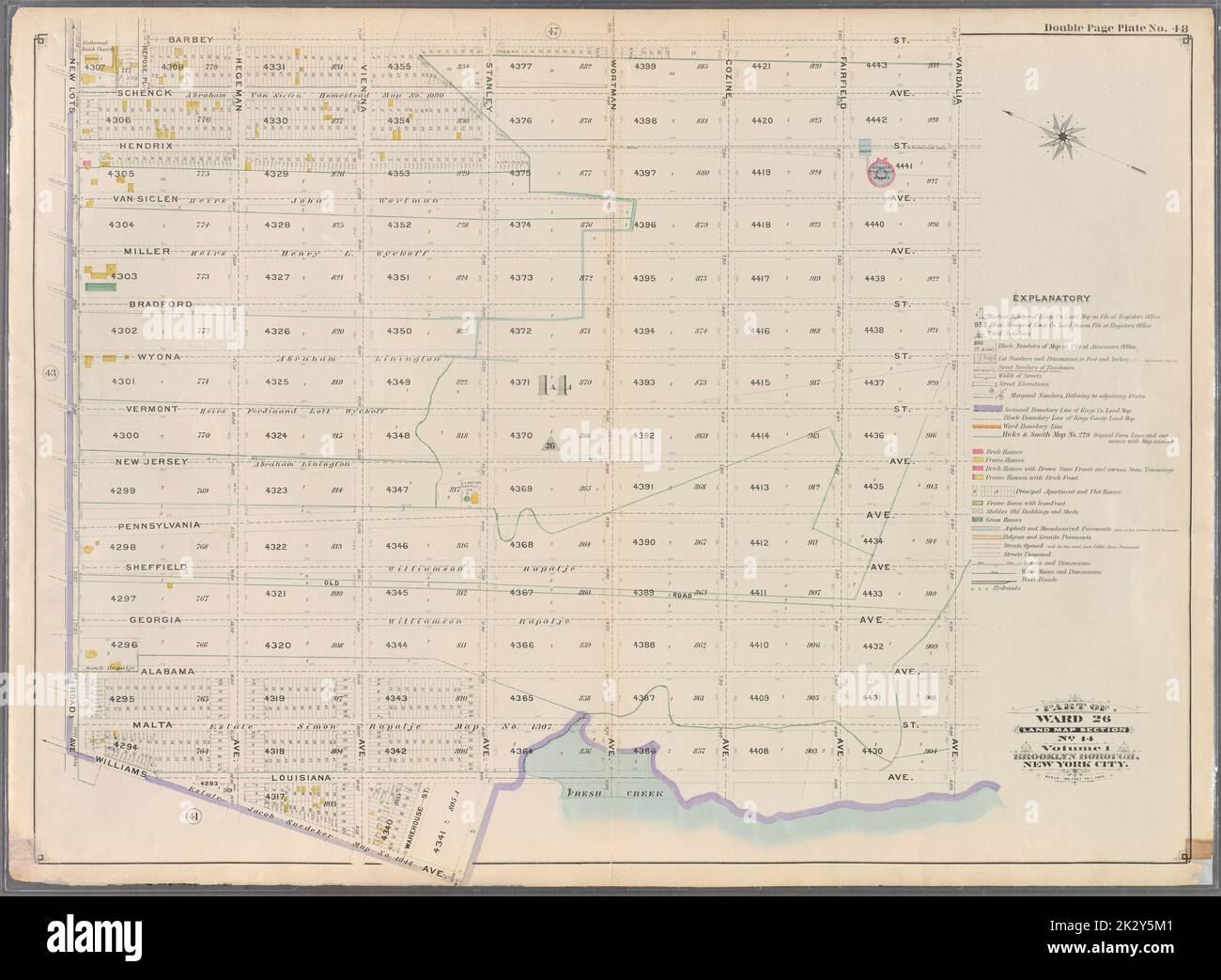
Cartographic, Maps. 1898. Lionel Pincus and Princess Firyal Map Division. Brooklyn (New York, N.Y.), Real property , New York (State) , New York Double Page Plate No. 48: Bounded by Barbey Street, Vandalia Avenue, Louisiana Avenue, Williams Avenue and New Lots Avenue. Part of Ward 26. Land Map Section, No. 14. Volume 1, Brooklyn Borough, New York City.
RMID:Image ID:2K2Y5M1
Image details
Contributor:
Ny/piemags / Alamy Stock PhotoImage ID:
2K2Y5M1File size:
76.2 MB (3.6 MB Compressed download)Releases:
Model - no | Property - noDo I need a release?Dimensions:
6027 x 4421 px | 51 x 37.4 cm | 20.1 x 14.7 inches | 300dpiMore information:
This image is a public domain image, which means either that copyright has expired in the image or the copyright holder has waived their copyright. Alamy charges you a fee for access to the high resolution copy of the image.
This image could have imperfections as it’s either historical or reportage.