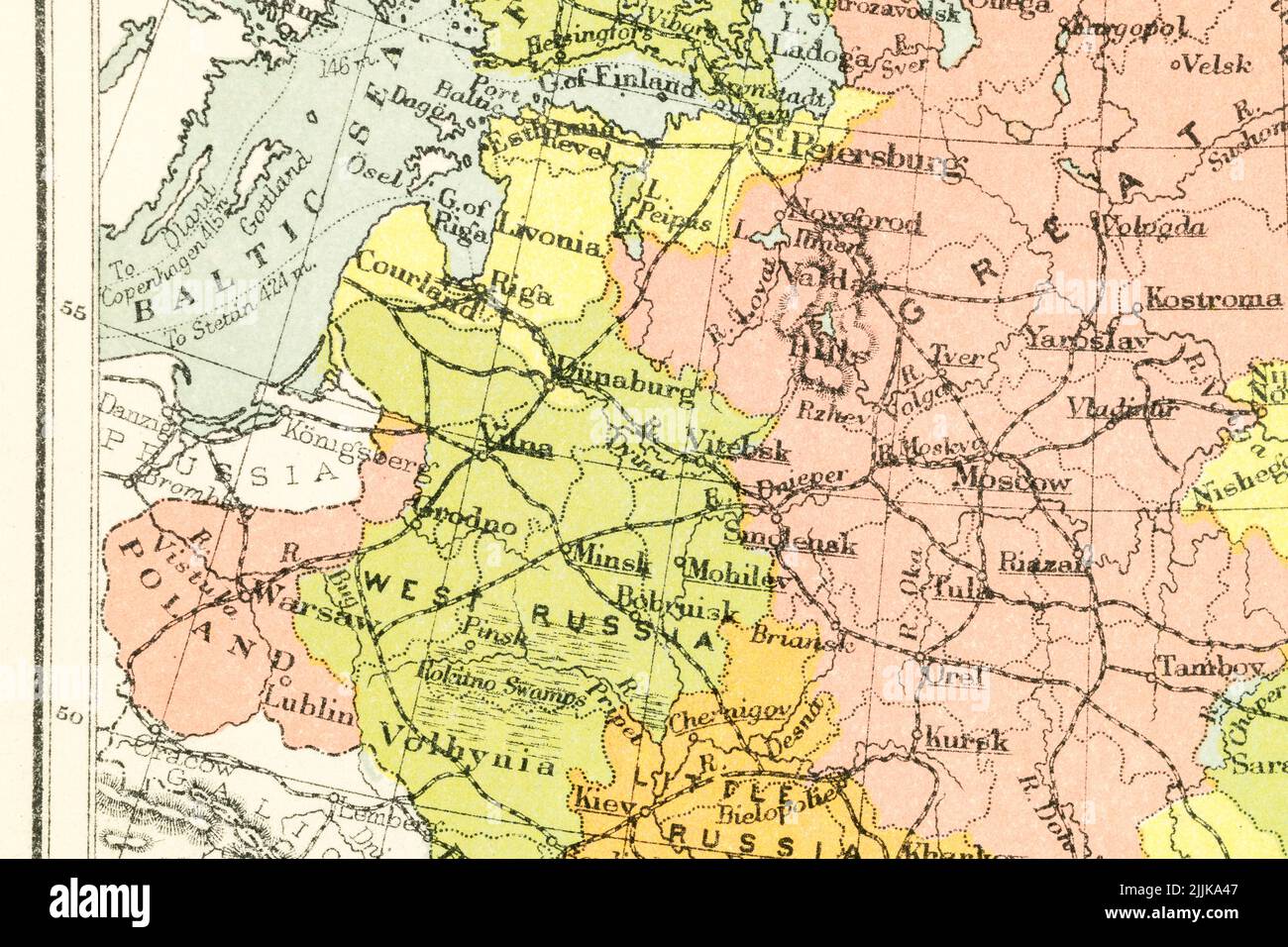
c.1895 pre-Soviet atlas map of Baltic states: Estonia, Latvia (Livonia), Lithuania (Kurland, Courland) bordering Russia + Kaliningrad, Poland, Belarus
Image details
Contributor:
Marcus Harrison - geopolitics / Alamy Stock PhotoImage ID:
2JJKA47File size:
129.3 MB (6.5 MB Compressed download)Releases:
Model - no | Property - noDo I need a release?Dimensions:
8233 x 5489 px | 69.7 x 46.5 cm | 27.4 x 18.3 inches | 300dpiDate taken:
26 July 2022Location:
ukMore information:
Image of map in The New Victoria Shilling Atlas published by George Gill & Sos Ltd., UK. Publication date unknown but an identical copy with a personal inscription dated 1898 puts it then or before, while I have seen reference to it being published around 1895. The Gill company were based at 12 Warwick Lane in London and only ceased trading in 1941. The original Gill died on November 24, 1901, while his sons, George Reginald Gill (1862 - ?) and Claude Edward Gill (August 30, 1872 - August 16, 1960), took over. I am not sure how that leaves us with rights for these so have put Editorial Only..... By all accounts (at least according to the Bodleian Library) general map copyright in the UK exists for 70 years after the date of publication - and not 70 years after the author's / originator's death as with literary works. See https://www.bodleian.ox.ac.uk/maps/reproducing-maps