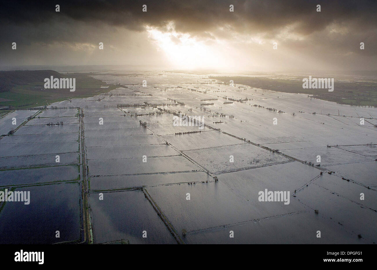
An aerial view of the Somerset Levels which shows the true extent of the flooding in the South West,
Image details
Contributor:
SWNS / Alamy Stock PhotoImage ID:
DPGFG1File size:
28.2 MB (2.1 MB Compressed download)Releases:
Model - no | Property - noDo I need a release?Dimensions:
3900 x 2527 px | 33 x 21.4 cm | 13 x 8.4 inches | 300dpiDate taken:
6 January 2014Location:
Somerset, England, UKMore information:
An aerial view of the Somerset Levels which shows the true extent of the flooding in the South West, as much of the UK continues to endure bad weather and flooding. 6th January 2013. More than ONE HUNDRED residents are trapped in their village after floods have left all access roads under three feet of water. The Somerset village of Muchelney, which lies in between Taunton and Yeovil, has been cut off for four days after the roads flooded. Residents can now only able to leave the village by boat - the water is so deep not even a tractor can make it through. Many of the villagers were able to get essential supplies yesterday (Mon) after a boat travelled to meet a Tesco delivery that had been ordered.