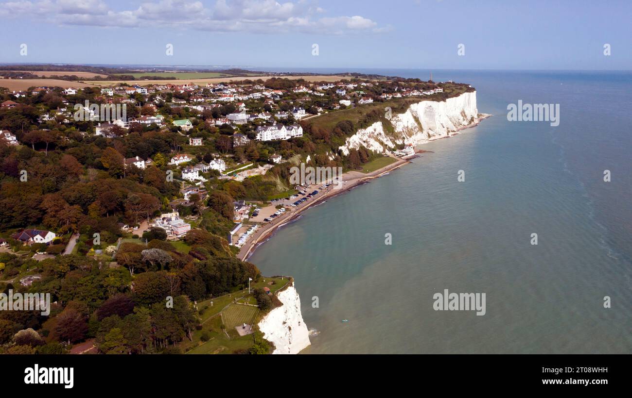
Aerial view of St Margaret's Bay, from the West side, looking East.
Image details
Contributor:
John Gaffen / Alamy Stock PhotoImage ID:
2T08WHHFile size:
48 MB (2.1 MB Compressed download)Releases:
Model - no | Property - noDo I need a release?Dimensions:
5464 x 3070 px | 46.3 x 26 cm | 18.2 x 10.2 inches | 300dpiDate taken:
30 September 2023Location:
St Margaret's Bay, Kent, UKMore information:
St. Margaret's at Cliffe is a three-part village situated just off the coast road between Deal and Dover in Kent, England. The centre of the village is about ¾ mile (1km) from the sea, with the residential area of Nelson Park further inland, and St Margaret's Bay situated along and below the cliffs north of South Foreland. The parish church, dedicated to St Margaret of Antioch, is a Grade I listed building. Channel swimmers and submarine telephone cables start from St Margaret's Bay. At the north end of the bay is Leathercote Point (sometimes spelt Leathercoat Point or Lethercote Point), where there is the Dover Patrol Monument war memorial commemorating the Dover Patrol. According to the International Hydrographic Organization, Leathercote Point marks the western end of the line which defines the divide between the North Sea and the English Channel, the opposite end being at the Walde Lighthouse near Calais.