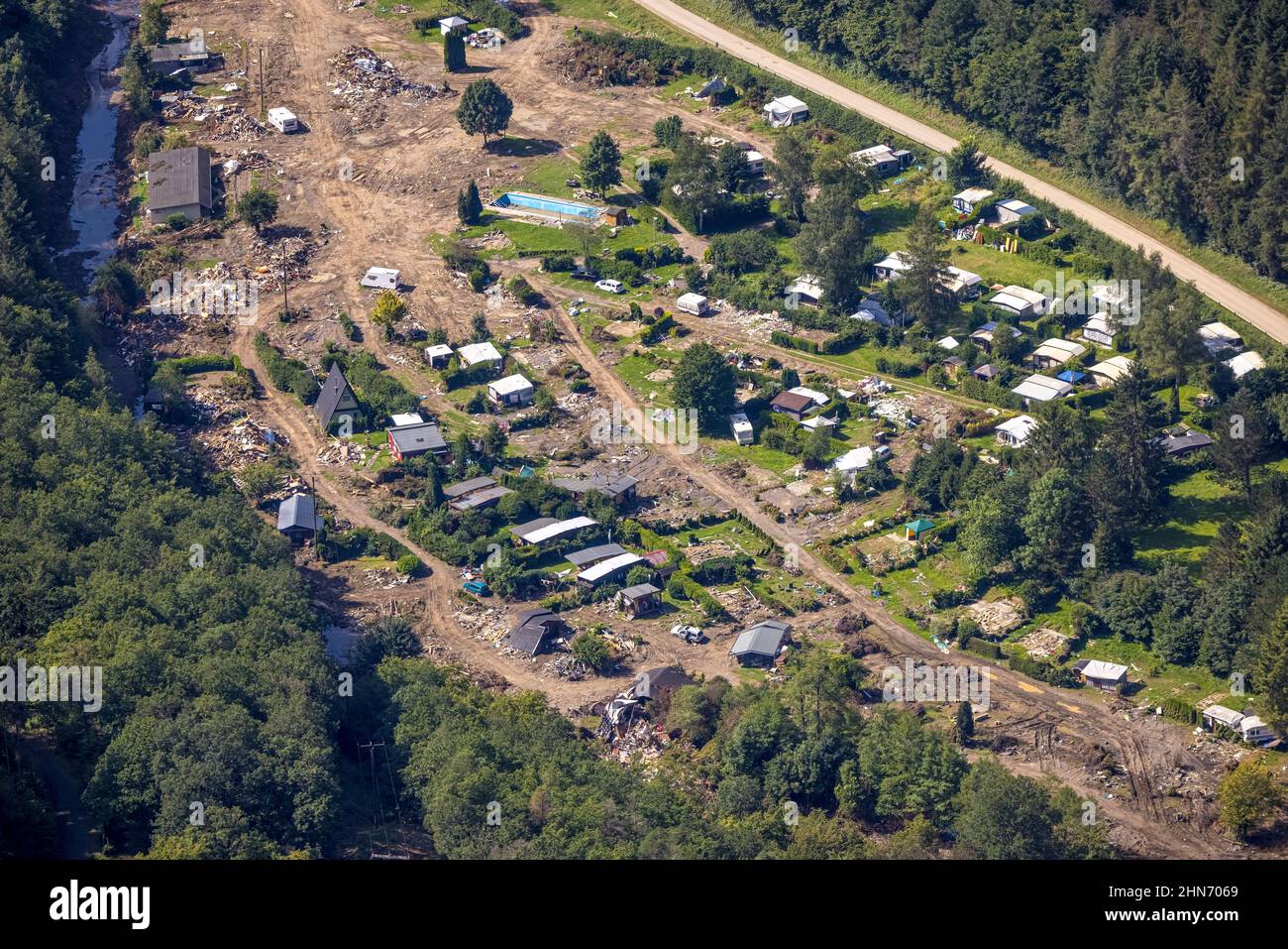
Aerial view, flooded area at the river Ahr and by flood disaster destroyed camping site Sahrtal Ute Vaßmer at the Sahrbach in the district Kreuzberg,
Image details
Contributor:
Hans Blossey / Alamy Stock PhotoImage ID:
2HN7069File size:
128.1 MB (11.4 MB Compressed download)Releases:
Model - no | Property - noDo I need a release?Dimensions:
8192 x 5464 px | 69.4 x 46.3 cm | 27.3 x 18.2 inches | 300dpiDate taken:
25 August 2021More information:
Aerial view, flooded area at the river Ahr and by flood disaster destroyed camping site Sahrtal Ute Vaßmer at the Sahrbach in the district Kreuzberg, Altenahr, Ahr flood, Ahrtal, Rhineland-Palatinate, Germany, camping, camping site, camping houses, camper, campsite, DE, Europe, flood disaster, floods, flood of the century, aerial photograph, aerial photography, aerial photography, overview, bird's eye view, camper, caravan, birds-eyes view, overview, flooding, inundation, flooded area, Luftbild, Überschwemmungsgebiet am Fluss Ahr und durch Flutkatastrophe zerstörter Campingplatz Sahrtal Ute Vaßmer am Sahrbach im Ortsteil Kreuzberg, Altenahr, Ahr-Hochwasser, Ahrtal, Rheinland-Pfalz, Deutschland, Camping, Campinganlage, Campinghäuser, Campingmobil, Campingplatz, DE, Europa, Flutkatastrophe, Hochwasserkatastrophe, Jahrhunderthochwasser, Luftaufnahme, Luftbildfotografie, Luftfotografie, Uebersicht, Vogelperspektive, Wohnmobil, Wohnwagen, birds-eyes view, overview, Überflutung, Überschwemmung, Überschwemmungsgebiet