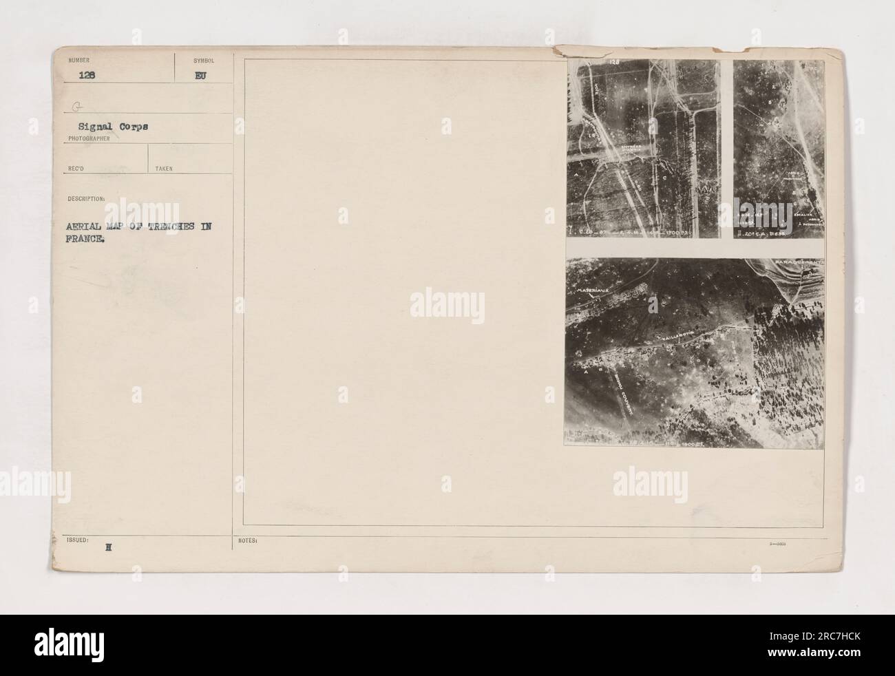
Aerial map showing the trench system in France during World War I. This map was taken and issued by the 128th G Signal Corps. It provides a detailed description of the trenches and includes handwritten notes on it.
RMID:Image ID:2RC7HCK
Image details
Contributor:
piemags/NSC / Alamy Stock PhotoImage ID:
2RC7HCKFile size:
165.4 MB (3.6 MB Compressed download)Releases:
Model - no | Property - noDo I need a release?Dimensions:
9177 x 6301 px | 77.7 x 53.3 cm | 30.6 x 21 inches | 300dpiDate taken:
24 August 2016More information:
This image is a public domain image, which means either that copyright has expired in the image or the copyright holder has waived their copyright. Alamy charges you a fee for access to the high resolution copy of the image.
This image could have imperfections as it’s either historical or reportage.