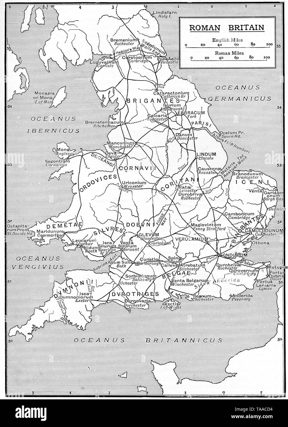
A map showing the infrastructure of Roman Britain, 1925.
RMID:Image ID:TAACD4
Image details
Contributor:
The History Emporium / Alamy Stock PhotoImage ID:
TAACD4File size:
50.4 MB (3.2 MB Compressed download)Releases:
Model - no | Property - noDo I need a release?Dimensions:
3565 x 4944 px | 30.2 x 41.9 cm | 11.9 x 16.5 inches | 300dpiDate taken:
1925More information:
This image could have imperfections as it’s either historical or reportage.