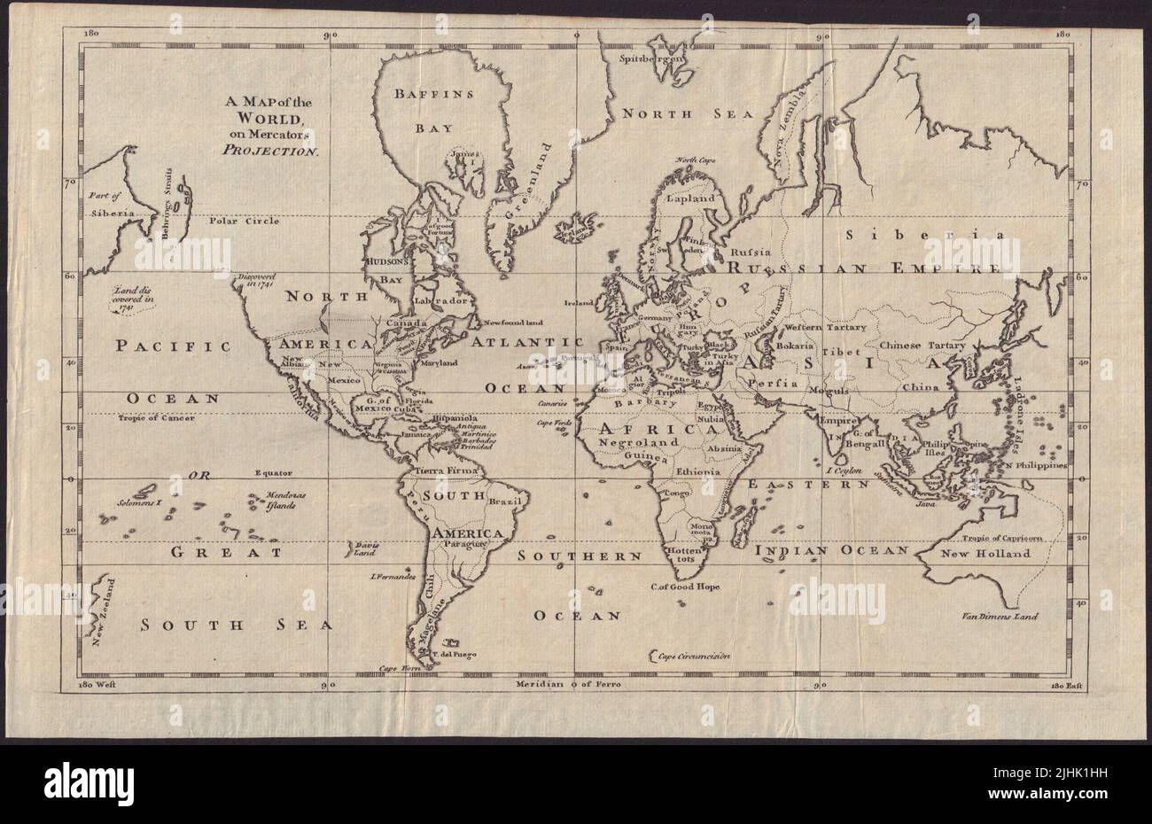
A map of the world on Mercators Projection. Davis Land. GENTS MAG 1755 old
Image details
Contributor:
Antiqua Print Gallery / Alamy Stock PhotoImage ID:
2JHK1HHFile size:
25.9 MB (1.6 MB Compressed download)Releases:
Model - no | Property - noDo I need a release?Dimensions:
3743 x 2421 px | 31.7 x 20.5 cm | 12.5 x 8.1 inches | 300dpiDate taken:
1755Location:
WorldMore information:
This image could have imperfections as it’s either historical or reportage.
A map of the World, on Mercators Projection. Artist/engraver/cartographer: Unattributed. Provenance: "Gentleman's Magazine and Historical Chronicle", by Sylvanus Urban, Gent. London: Printed for D. Henry & R. Cave, at St. John's Gate . Type: Antique copperplate map. The map notes the European discovery of Alaska in 1741, and shows in dotted outline a pre-Cook guess at the east coast of Australia. Also marked is Davis Land, a phantom island that was believed to be located in the Pacific Ocean, near South America. It is named for the pirate Edward Davis, who supposedly sighted it in 1687. Never found again, it was also believed by William Dampier to possibly be the coast of Terra Australis Incognita.